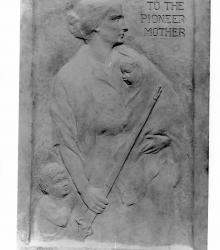
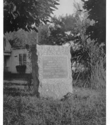
Photograph of the Daughters of Old Westport Memorial at the intersection of Broadway, Washington Street, and 40th Street.
Elizabeth Benton Chapter, DAR
Displaying 1 - 12 of 23
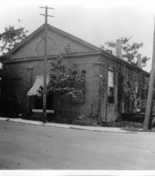
Photograph with full street level, exterior view of the First Presbyterian Church, once located at the southwest corner of Pennsylvania Avenue and 40th Street in Westport. The church was constructed in 1859, sold as a private residence in 1895, and razed before 1950.
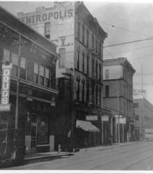
Circa 1915 photograph with view of 5th Street looking east-northeast toward its intersection with Grand Avenue (now Grand Boulevard) in the right background. Also pictured is Centropolis Hotel (center) and American Steel and Wire Company (right).
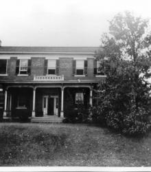
Circa 1920 photograph with full, front view of the Harris (Kearney) House at its original location at Westport Avenue (now Westport Road) and Main Street. This vantage point faces southeast from Westport Avenue just east of Main Street. The house was moved to 40th Street and Baltimore Avenue in 1922.
Photograph of the Santa Fe Trail marker located at the southeast corner of Blue Ridge Drive and 66th Street in present-day Raytown, Missouri. This vantage point face southeast with the Rice-Tremonti House in background partially showing. Marker placed by the DAR and the state of Missouri, 1909.
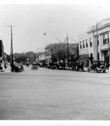
Photograph of Westport Avenue (now Westport Road), looking east-northeast from the northwest corner of Westport Avenue and Broadway Boulevard.

Photograph of the First Presbyterian Church, once located at the southwest corner of Pennsylvania Avenue and 40th Street in Westport. The church was constructed in 1859, sold as a private residence in 1895, and razed before 1950. This vantage point faces east on 40th Street from just west of the intersection of 40th and Pennsylvania.
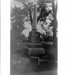
Photograph with view of large, obelisk tombstone with the name "Armstrong" engraved on it located in Huron Cemetery in downtown Kansas City, Kansas, on Minnesota Avenue between 6th and 7th Street.
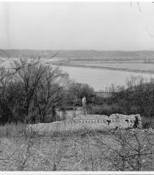
Photograph with view of Quindaro ruins located in Kansas City, Kansas. Missouri River is visible in the background. Town of Quindaro was built in 1857. This vantage point faces north and shows the Missouri River in the background.
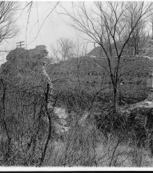
Photograph with view of Quindaro ruins, Kansas City, Kansas, showing portions of remaining stone wall.
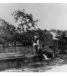
Circa 1920 photograph with full view of Watts Mill including view of Indian Creek and rock ledge, Dallas, Missouri. This vantage point faces north from the southeast bank of Indian Creek.
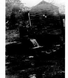
Circa 1920 photograph with partial view of Watts Mill including view of Indian Creek in Dallas, Missouri. This vantage point faces northwest from the southeast bank of Indian Creek.