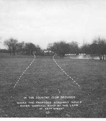
Photograph with caption, "in the Country Club grounds where the proposed roadway would enter Wornall Road by the lake at 5nd Street." This vantage point faces northeast near the center of present day Loose Park.
Streets
Displaying 265 - 276 of 706
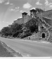
Photograph looking north along Kersey Coates Drive near the end of 10th Street. The palisades or cliffs of West Terrace Park are in view.
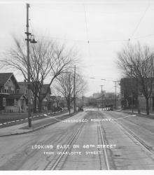
Photograph with caption, "looking east on 48th Street from Charlotte Street." The photograph's annotations label streets and show proposed road improvements.
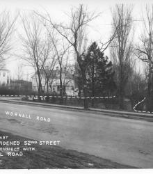
Photograph with caption, "looking east where widened 52nd Street would connect with Wornall Road." The photograph's annotations label streets and show proposed road improvements.

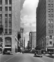
Photograph looking north up Baltimore Avenue from near 16th Street. The Kansas City Power and Light Building is in full view in the center of the photograph. The sign for the President Hotel is also in view on the right.
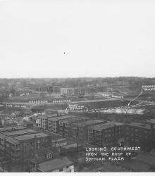
Photograph with caption, "looking southwest from the roof of Sophian Plaza" at the northwest corner of Warwick Boulevard and Brush Creek Boulevard (presently Emanuel Cleaver II Boulevard). The Country Club Car Line and E.C. White School (center background) are pictured.
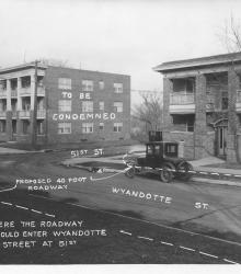
Photograph with caption, "Where the roadway would enter Wyandotte Street at 51st." This vantage point faces northeast from near the intesection of Wyandotte and 51st. The photograph's annotations label streets and show proposed road improvements.
Photograph of Baltimore Avenue looking north from 14th Street. The description on the back of the photograph reads: "Balt. Ave. looking north from 14th St. Bldg on left [background] is the K.C. Club bldg. and on the right [background] is Kansas City's largest retail furniture store, the Robt.
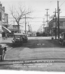
Photograph with caption, "looking east on 47th Street showing noonday congestion of traffic at Troost Avenue." Piggly Wiggly and Crown Drug Co. are pictured.
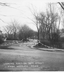
Photograph with caption, "looking east on 52nd Street from Wornall Road." The photograph's annotations show proposed road improvements.
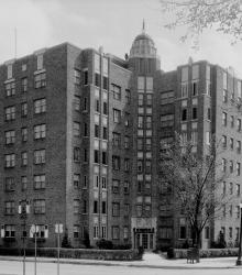
Photograph of the Mark Twain Apartment building located at the southeast corner of 48th Street and Roanoke Parkway.
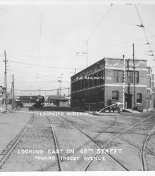
Photograph with caption, "looking east on 48th Street toward Troost Avenue." This vantage point faces east-northeast from the intersection of 48th Street and Harrison Street and shows a K. C. Railways Co. building.