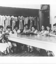
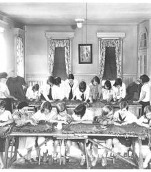
Photograph of eight women at a sewing class at the Guadalupe Center.
Missouri Valley Special Collections, Kansas City Public Library
Displaying 229 - 240 of 1502

Photograph of a man posed with a large herd of sheep at the Stockyards in the West Bottoms of Kansas City.
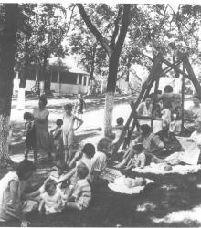
Photograph with slide description: "Salvation Army Fresh Air Camp, south of Independence, Mo." The camp was once located two miles east of Blue Ridge Road (presently Blue Ridge Cutoff) on U.S. Highway 40.
Photograph with full frontal and side view of the Grand Avenue Temple church and office building, located on the southeast corner of 9th Street and Grand Avenue. Advertisements for L.J. Baer & Company are pictured.
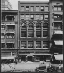
Circa 1928 photograph with full frontal view of the Merry Building; located at 1009-11 Walnut Street. Businesses noted in the building include: Merry Optical Company, Nisley's Shoes, Cady & Olmstead Jewelry, and Hoefer Jewelry Company.
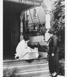
Photograph of the front entrance to the Harry M. Evans Children's Home-Finding Society, showing a young child in a basket looking at a visitor. The home cared for children under five with an average of thirty per month. The image is featured in the photograph section of the October 29, 1933 issue of the Kansas City Star.
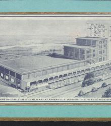
Circa 1928 drawing showing the full frontal and side view of the Southard Feed and Milling Company plant at 17th Street and Cookson Avenue (Potter Avenue), Kansas City, Missouri.
Photograph with slide description, "Campfire Girls working on uniforms at the Whatsoever Community House, K.C., Mo."
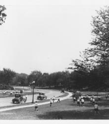
Circa 1920 photograph with slide description, "Girls from Westport Jr. High playing ball south of Hyde Park; Kansas City, Mo." This vantage point faces southeast on the west side of Gillham Road between 38th Street and 39th Street. The Santa Fe Trail Marker on Gillham Road is pictured.
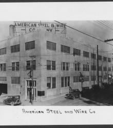
Circa 1928 photograph with frontal and side view of the American Steel and Wire Company; located at 417-23 Grand Avenue.
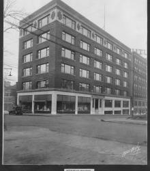
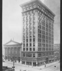
Circa 1928 photograph with frontal and side view of the Inter-State (Interstate) Building, located at the southwest corner of 13th and Locust streets.
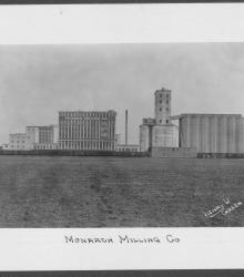
Circa 1928 photograph with distant view of Monarch Milling Company facility. Little Princess Flour sign on building as well as Commander-Larabee Corp. This vantage point faces east near the defunct intersection of Lydia Avenue and Armour Road. The facility was demolished in 2012.