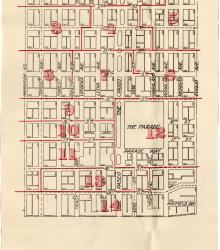
Map showing the boundaries of precincts as defined in 1918 for the eighth ward of Kansas City, Missouri. This ward is bounded by 9th Street to the north, Harrison Street to the west, 20th Street to the south, and Euclid Avenue to the east.
South
Displaying 145 - 156 of 383
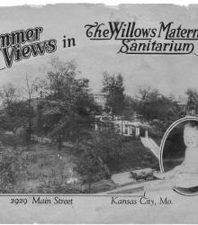
Circa 1926 picture book depicting Willows Maternity Sanitarium during the summer months. Included are pictures of the staff with infants born at the institution, as well as photographs of the facilities. This pamphlet was published for perusal by doctors with patients in need of a maternity hospital.
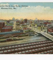
Postcard showing the Kansas City, Missouri business district from atop Union Station. This elevated vantage point faces north, showing Main Street on the right and the H. D. Lee Mercantile Company Building at 20th and Wyandotte on the left. The back of the postcard includes a brief caption about this city district and a short letter to Ira D.
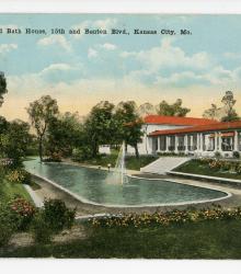
Postcard showing the bathing pool and bathhouse at The Grove, located at Benton Boulevard and 15th Street (now Truman Road) in Kansas City, Missouri. This vantage point faces northwest towards the bath house and wading pool from just north of the intersection of Benton Plaza (pictured left) and Bellefontaine Avenue.
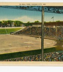
Postcard showing Muehlebach Field (later Ruppert/Blues/Municipal Stadium), once located west of Brooklyn Avenue between 21st and 22nd Street in Kansas City, Missouri. This vantage point faces east-southeast towards the bases and right field. The back of the postcard includes a short letter to Anna Dyer of Boston, Massachusetts.
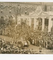
Postcard showing the reviewing stand in front of The Kansas City Star building for the American Legion Parade in Kansas City, Missouri. This parade, along with the Liberty Memorial dedication, took place over three days in late 1921: October 30, 31 and November 1st. Gen. Jacques of Belgium, Gen.
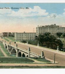
Postcard of the 27th Street bridge over Vine Street in Troost Park (now Troost Lake Park), Kansas City, Missouri. This vantage point faces west just east of Highland Avenue and to the south of the bridge, and shows the Christian Church Hospital in the distance.
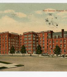
Postcard of the New German (Research) Hospital, located at the southwest corner of 23rd Street and Holmes Street in Kansas City, Missouri. This vantage point faces southwest from just east of the intersection of 23rd Street and Holmes Street.

Postcard of the Lakeside Hospital, located just south of Troost Lake between Flora Avenue and Wayne Avenue (now Vine Street) in Kansas City, Missouri. This vantage point faces southeast from just south of the intersection of The Paseo and 28th Street. The back of the postcard includes a short letter to Mrs. C. W. Cannon of Garnett, Kansas.
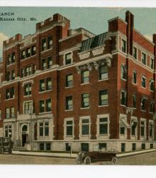
Postcard of the Research Hospital, located at the southwest corner of 23rd Street and Holmes Street in Kansas City, Missouri. This vantage point faces southeast from the intersection of 23rd Street and McCoy Avenue (now Kenwood Avenue). The back of the postcard includes a short letter to from Frances E. Farrell to Mrs.
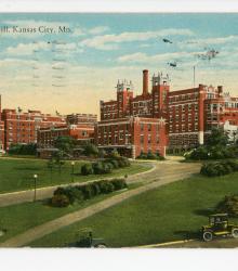
Postcard of the Hospital Hill on 23rd Street in Kansas City, Missouri. This vantage point faces southeast from near the intersection of Gillham Road and 22nd Street. The back of the postcard includes a brief caption about Hospital Hill and a short letter to Mr. Kenith Lee Thomas of Troy, Kansas.
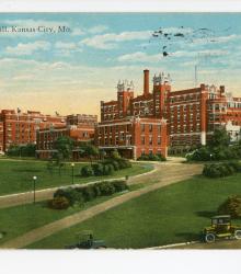
Postcard of the Hospital Hill on 23rd Street in Kansas City, Missouri. This vantage point faces southeast from near the intersection of Gillham Road and 22nd Street. The back of the postcard includes a brief caption about Hospital Hill and a short letter to Mrs. J. C. Hardin of St. Joseph, Missouri.