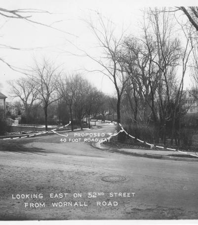
Photograph with caption, "looking east on 52nd Street from Wornall Road." The photograph's annotations show proposed road improvemen
Economic Boom, Depression, and Recovery
Image Gallery
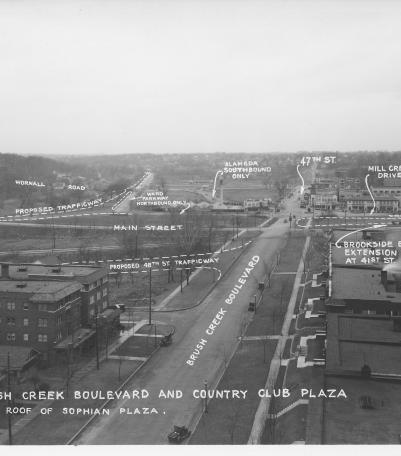
Photograph with caption, "Brush Creek Boulevard and Country Club Plaza [looking west] from roof of Sophian Plaza." The annotations on the
1926
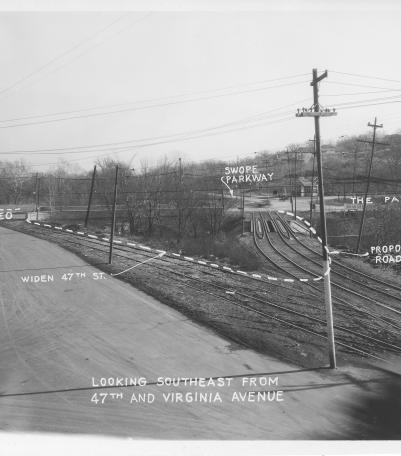
Photograph with caption, "looking southeast from 47th and Virginia Avenue." The photograph's annotations label streets and show prop
1926
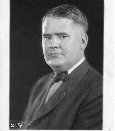
Portrait of Dr. Ernest W. Cavaness, City Hospital, 1926). At the time, Cavaness was the city health director for Kansas City, Missouri.
1926

Photograph with caption, "looking northeast along 52nd Street from Central Street." The photograph's annotations label streets and s
1926
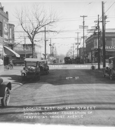
Photograph with caption, "looking east on 47th Street showing noonday congestion of traffic at Troost Avenue." Piggly Wiggly and Crown Dr
1926
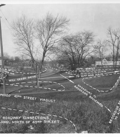
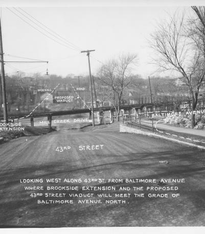
Photograph with caption, "Proposed roadway connections, in Park Land, north of 43rd Street." This vantage point faces north-northwest fro
1926
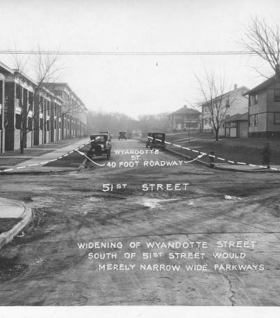
Photograph with caption, "widening of Wyandotte Street south of 51st Street would merely narrow wide parkways." This vantage point faces
1926
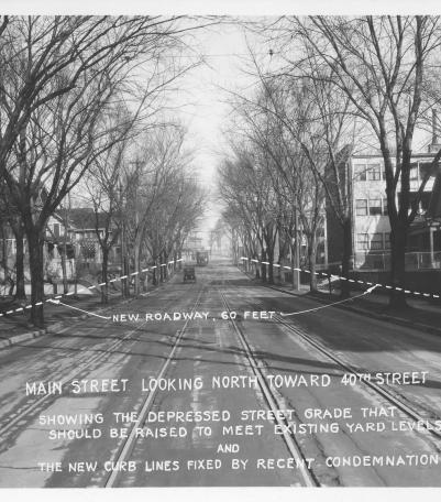
Photograph with caption, "Main Street looking north toward 40th Street showing the depressed street grade that should be raised to meet existi
1926
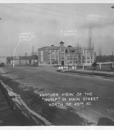
Photograph with caption, "Another view of the 'hump' in Main Street north of 49th St." This vantage point faces north-northeast
1926

Photograph with caption, "Main Street at 41st, looking north showing the proposed diagonal connection with Brookside Boulevard and new 60 foot
1926

Photograph with caption, "The former brickyard and rock quarry south of Brush Creek and west of Main Street." This vantage point faces so
1926
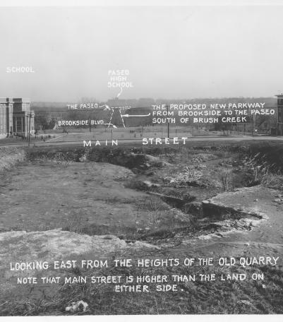
Photograph with caption, "looking east from the heights of the old quarry.
1926

Photograph with caption, "looking west from Forest Avenue" just south of 47th Street and showing the proposed east extension of 48th Stre
1926