
Circa 1930 photograph of students and a teacher on a double-decker bus parked outside of the Woodland Public School, located on the north side of 8th Street between Woodland Avenue and Euclid Avenue. This vantage point faces southwest from near the south-facing southwest entrance to the school.
Streets
Displaying 85 - 96 of 706
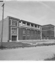
Photograph of the E. F. Swinney School, located on the north side of 47th Street between Holly Street and Jarboe Street. The school was named for Edward F. Swinney, treasurer of the Board of Education, 1894 to 1904. This vantage point faces northeast from the south side of 47th just east of Holly.
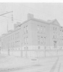
Photograph of the Yeager School, once located at the northwest corner of Indiana Avenue and 19th Street. It was built in 1894 and named for Robert L. Yeager, a lawyer and member of the Board of Education.
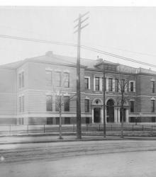
Photograph of the Thacher School, once located at the northwest corner of Independence Avenue and Quincy Avenue. It was named for Major Luin E. Thacher, an early member of the school board. This vantage point faces north-northeast from the southwest corner of Independence Avenue and Brighton Avenue.
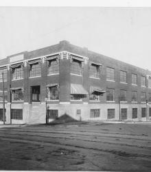
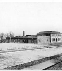
Photograph with exterior, street level view of the repair or shop building maintained by the Kansas City School District. It is located at the northeast corner of 21st Street and Charlotte Street.
Photograph of the Mark Twain Public School, once located on the north side of 60th Street between Swope Parkway and Jackson Avenue. This vantage point faces northeast from the property at 3825 East 60th Street.
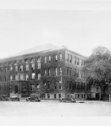
Circa 1930 photograph with an exterior, street level view of the Manual Training High School located on the south side of 15th Street (Truman Road) between Forest Avenue and Tracy Avenue. This vantage point faces southeast from the northwest corner of 15th and Forest.
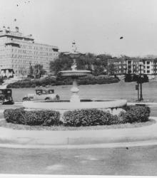
Photograph looking northeast with slide description: "Venetian fountain, 47th and Mill Creek; Kansas City, Mo. (1931)."
Circa 1928 photograph with frontal and side view of Burnap-Meyer, Incorporated, a printing company; located at 1021 McGee Street. This vantage point faces east-northeast across McGee Street.

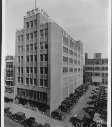
Circa 1928 photograph with full frontal and side view of the Produce Exchange Bank, located on the southeast corner of Missouri Avenue and Walnut Street.
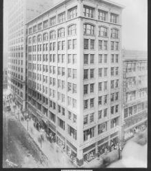
Photograph with full frontal and side view of the Sharp Building, located on the northwest corner of 11th and Walnut streets. Businesses in view include Federmann's Drugstore, Olney Music Company, Woolf Brothers, etc.
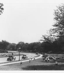
Circa 1920 photograph with slide description, "Girls from Westport Jr. High playing ball south of Hyde Park; Kansas City, Mo." This vantage point faces southeast on the west side of Gillham Road between 38th Street and 39th Street. The Santa Fe Trail Marker on Gillham Road is pictured.