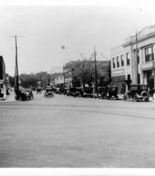
Photograph of businesses at the southwest corner of Grand Avenue (presently Grand Boulevard) and 3rd Street.
Street railroad tracks
Displaying 37 - 48 of 71
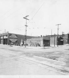
Photograph of the Rutherford Chile Con Carnie Co. Building, once located at the northeast corner of Grand Avenue (presently Grand Boulevard) and 3rd Street.
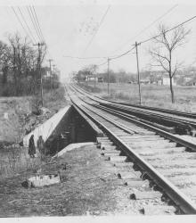
Circa 1925 photograph of the Sunset Hill Line streetcar bridge over Brush Creek. This vantage point faces north up Belleview Avenue towards its intersection with 48th Street in the background.
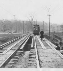
Circa 1925 photograph of a man posed on top of the Sunset Hill Line streetcar bridge over Brush Creek at Belleview Avenue. This vantage point faces south to where the streetcar joins Ward Parkway in the background.
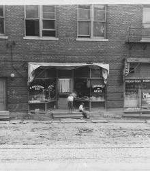
Photograph of unidentified boys before a grocery and drugstore at the northeast corner of 23rd Street (presently Avenida Cesar E Chavez) and Summit Street. This vantage point faces east on Summit Street just north of 23rd Street.
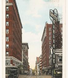
Postcard looking east past the intersection of 12th Street and Wyandotte Street. Pictured is the Hotel Stats (left foreground), Hotel Muehlebach (right), and the Gayety Theater (right foreground).
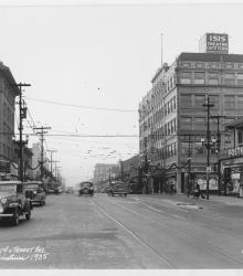
Photograph looking south along Troost Avenue from just north of 31st Street. Streets are shown outfitted with Christmas decorations. Isis Theatre and the Wirthman Building are pictured to the right.
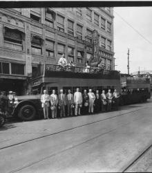
Photograph of Kansas City officials posed next to a sightseeing bus in front of the Isis Theater and Wirthman Building after attending a luncheon celebrating the widening of Linwood Boulevard.
Photograph of Westport Avenue (now Westport Road), looking east-northeast from the northwest corner of Westport Avenue and Broadway Boulevard.
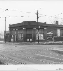
Photograph of an abandoned building at the southwest corner of 19th Street and Vine Street in Kansas City, Missouri. The building used to house a Sam's Market and a shoe shining parlor.
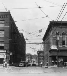
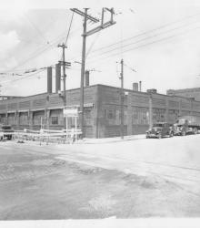
Street scene showing the Kansas City Public Service Company Building (also known as the Kansas City Railway Company or K.C. Rys. Co. from 1914-1925) on the left. This building was located on the south side of 15th Street (now Truman Road) between Grand Avenue (now Grand Boulevard) and Walnut Street.
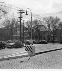
Photograph of "streamlined" Safety Zones intended to protect patrons at streetcar stops, Kansas City, Missouri, ca. 1930s. This vantage point faces south-southeast on Main Street from just north of Armour Boulevard.