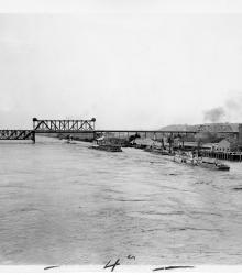
Armour-Swift-Burlington Bridge, with the Mark Twain and the General Ashburn, stern wheelers, carrying Patrick J. Hurley, Secretary of War, and his party on a trip to demonstrate the navigability of the Missouri River. This vantage point faces east towards the bridge and the south bank of the Missouri River.
Rivers
Displaying 37 - 41 of 41
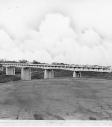
Photograph of the bridge over the Blue River at 63rd Street, which provided access to the Jackson County road system. This vantage point faces northwest towards the bridge from south of 63rd Street and east of Blue River.
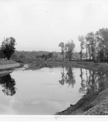
Photograph of improvements made to Blue River south to the limits of Swope Park, Kansas City, for purposes of flood control, ca. 1930s. This vantage point faces southwest from just south of 15th Street (now Truman Road). This photograph was taken before the river was diverted to west of Manchester Avenue (now Manchester Trafficway).
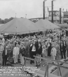
The Kansas City Welcoming Committee to Secretary Patrick J. Hurley and party under the auspices of Missouri River Navigation Association. Mr. Nichols can be seen in the back row, fourth from the left.

An black and white glass plate positive photograph of Thomas Hart Benton standing by the Blue River in Jackson County, Missouri.
Pages
- « first
- ‹ previous
- 1
- 2
- 3
- 4