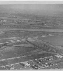
Circa 1930 photograph with an aerial view, looking east, of Fairfax Industrial and Municipal airports.
Rivers
Displaying 13 - 24 of 41
Circa 1930 photograph with an aerial view looking east across the Kansas River near west end of the Kansas Avenue Bridge; shows Cudahy Packing Company, Swift and Company, and the Kansas City Stockyards.
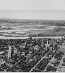
Circa 1930 photograph with an aerial view of downtown Kansas City looking northwest, taken over near 15th Street and Grand Avenue. Shows Missouri River, Municipal Airport, 2nd Hannibal Bridge, and ASB Bridge.
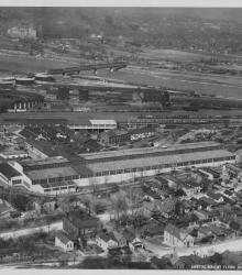
Circa 1930 photograph with an aerial view of Kansas City Structural Steel facility and grounds, once located north of Metropolitan Avenue between South 21st and 24th Street in Kansas City, Kansas.
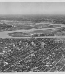
Circa 1930 photograph with an aerial view looking northwest toward downtown Kansas City taken over near 18th and Harrison streets. Shows the confluence of the Kansas and Missouri Rivers, Municipal Airport, and Fairfax area.

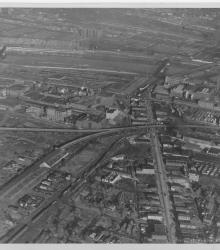
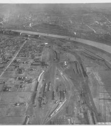
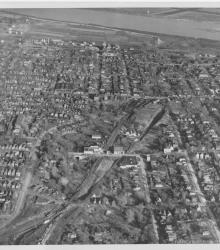
Circa 1930 photograph with an aerial view of a residential area and rail yard with roundhouse near the Kansas River in the Argentine neighborhood. This vantage point faces northwest and shows Armourdale to the right of the river.
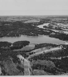
Circa 1930 photograph with an aerial view of Lake Quivira. Work on the lake and the surrounding area was started by the Quivira Development Company in 1927. The first stages of the project were completed by the early 1930s. This vantage point faces west with the Kansas River in the right background.
Circa 1930 photograph with an aerial view, looking east, across the Armourdale district and towards the Kansas River.
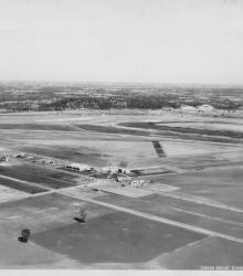
Circa 1930 photograph with an aerial view of Fairfax Industrial Airport in Kansas City, Kansas. It is noted on the back of the photograph that Curtiss Wright is at the northern end of the field. This vantage point faces northeast an shows the intersection of Funston Road and Fairfax Road (presently Fairfax Trafficway) in the center.
Circa 1930 photograph with an aerial view of northeast Kansas City, Kansas. This vantage point faces east and shows the area that will eventually be remade as Jersey Creek Park.
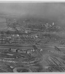
Circa 1930 photograph with an aerial view looking east-northeast across the West Bottoms from Kansas City, Kansas. Includes view of downtown Kansas City, Missouri, as well as the 2nd Hannibal Bridge and the ASB bridge. Both the Kansas and Missouri rivers in view.
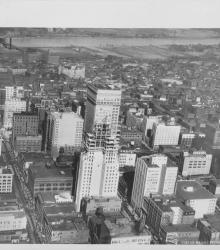
Circa 1930 photograph with an aerial view looking north near 12th Street and Grand Avenue; shows the Bryant Building under construction. Missouri River and riverfront area also in view.