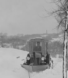
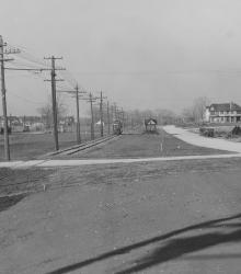
Motorized snowplows are called into action to clear the sidewalks of J. C. Nichols Companies homes in the Oak Meyer Gardens subdivision. This vantage point faces west on 65th Street just west of Cherry Street. Southwest High School at Wornall Road and 65th Street can be seen in the far background.
Houses
Displaying 109 - 120 of 272
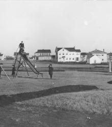
This picture was taken looking north-northeast at the southern tip of Wornall Manor playground, once located in the interior of block six, between 62nd and 63rd Streets, Valley Road and Summit Streets. Several children are shown playing on playground equipment while adults watch from a distance.
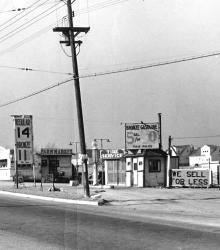
Northwest view from the southeast corner of U.S. Route 50 (now Shawnee Mission Parkway) and Belinder Road (now Belinder Avenue), showing a gas station.
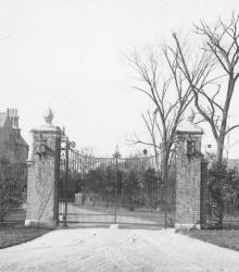
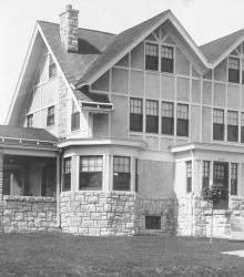
Entrance to 5110 Cherry Street, located in Southwood Park. The home belonged to Edwin W. Shields and construction was completed shortly after World War I. This vantage point faces west on Cherry Street between 51st Street and 52nd Street. This building is now part of the University of Missouri - Kansas City.
The Ruhr Dairy located just west of Belinder Road (now Belinder Avenue) and south of 54th Street. 54th Street in Kansas once ran directly east from the present intersection of Shawnee Mission Parkway and State Park Road. Although once part of Mission, Kansas, this area was developed by J. C. Nichols and incorporated as Fairway, Kansas.

Home of Arthur T. Bailey at 205 E. 65th Street in Armour Hills. This vantage point faces south-southwest on 65th Street just east of Morningside Drive.
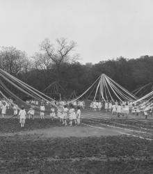
Younger boys and girls participating in maypole dance at the 1923 Field Day on the grounds of the Pembroke-Country Day School. This vantage point faces east-northeast towards houses on Sunset Hill in the far right background.
5434 Central Street home of Zeno T. Briggs, who bought a lot in 1909 and lived at this home until June 1929. This vantage point faces west-northwest on Central Street just north of 55th Street.
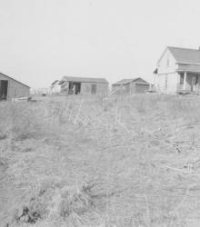
This picture was taken looking north at the southwest corner of Brookside Road and 66th Terrace. Wornall Road at the left.
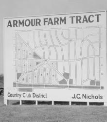
Men and women gaze at a J. C. Nichols Company sign showing available plots for sale in Armour Farm development.
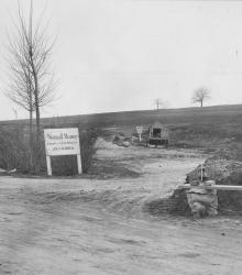
Sign for Wornall Manor, looking southwest from the intersection of Pennsylvania Avenue, Valley Road, and 62nd Street.
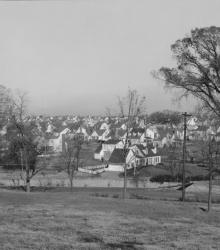
Wide view of the then-newest member of Country Club District, Fairway. The name was chosen because of the development's proximity to three golf courses. This vantage point faces northeast towards State Park Road between Canterbury Road and Falmouth Road from near the northern limits of the Kansas City Country Club.