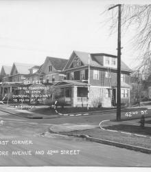
Photograph with caption, "northeast corner of Baltimore Avenue and 42nd Street." The photograph's annotations label streets and show proposed road improvements.
Houses
Displaying 49 - 60 of 272
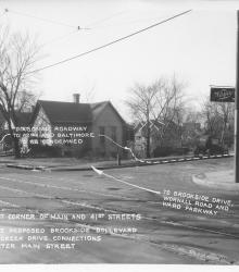
Photograph with caption, "southwest corner of Main and 41st Streets where the proposed Brookside Boulevard and Mill Creek Drive connections would enter Main Street." The photograph's annotations show proposed road improvements.
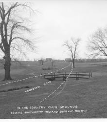
Photograph with caption, "in the Country Club grounds looking southwest toward 55th and Summit." The photograph's annotations show a proposed road.
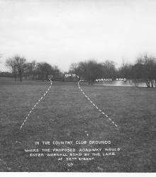
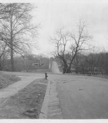
Photograph with caption, "in the Country Club grounds where the proposed roadway would enter Wornall Road by the lake at 5nd Street." This vantage point faces northeast near the center of present day Loose Park.
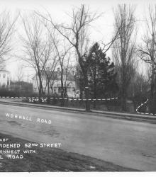
Photograph with caption, "looking east where widened 52nd Street would connect with Wornall Road." The photograph's annotations label streets and show proposed road improvements.
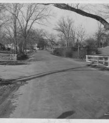
Photograph looking north on Brookside Boulevard just south of its intersection with 53rd Street Terrace.
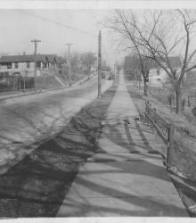
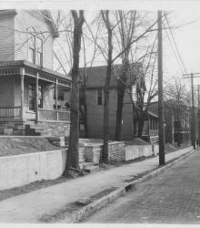
Photograph looking south on the east side of Bennington Avenue between Lee Street (15th Terrace) and 16th Street.
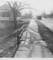
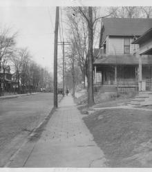
Photograph looking north on the east side of Bennington Avenue between Lee Street (15th Terrace) and 16th Street.
Circa 1925 photograph of Locust Street looking north between 39th Street and 40th Street. Locust Street north of 39th Street and the residence at 3826 Locust are shown in the distance.
Photograph looking south-southeast and showing the east side of the 500 block of Park Avenue.
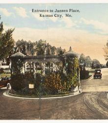
Postcard looking south towards the entrance to Janssen Place at the intersection of 36th Street and Janssen Place.