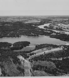
Circa 1930 photograph with an aerial view of Lake Quivira. Work on the lake and the surrounding area was started by the Quivira Development Company in 1927. The first stages of the project were completed by the early 1930s. This vantage point faces west with the Kansas River in the right background.
Aerial views
Displaying 13 - 24 of 51
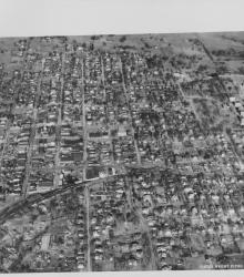
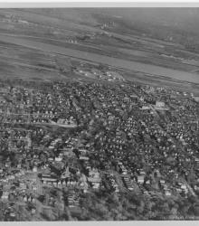
Circa 1930 photograph with an aerial view of Liberty, Missouri looking north. Shows the downtown area as well as William Jewell College on the right side of the photograph.
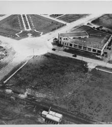
Circa 1930 photograph with an aerial view of Inland Aviation Company, also known as Inland Aircraft Company, once located at the southeast corner of Fairfax Road (presently Fairfax Trafficway) and Funston Road in Kansas City, Kansas. The Inland Sport was the first plane built and one of the fastest personal planes of the period.
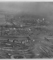
Circa 1930 photograph with an aerial view looking east-northeast across the West Bottoms from Kansas City, Kansas. Includes view of downtown Kansas City, Missouri, as well as the 2nd Hannibal Bridge and the ASB bridge. Both the Kansas and Missouri rivers in view.
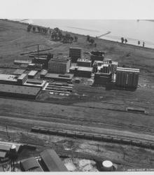
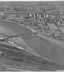
Circa 1930 photograph with an aerial view of the Corn Products Refining Company near the intersection of 10th Avenue and Bedford Avenue in North Kansas City, Missouri. This vantage point faces southeast and shows the Missouri River (background) and the Kansas City Car Company (left foreground).
Circa 1930 photograph with an aerial view looking east and showing a largely residential section of northeast Kansas City, Kansas; Fairfax; Missouri River; and North Kansas City, Missouri. Quindaro Boulevard is prominently shown diagonally in the photograph.
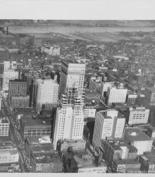
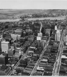
Circa 1930 photograph with an aerial view looking north near 12th Street and Grand Avenue; shows the Bryant Building under construction. Missouri River and riverfront area also in view.
Circa 1930 photograph with an aerial view looking north showing West Bottoms and stockyard area. Kansas River and bridges in view. Missouri River in distance on top and 12th Street Viaduct is visible.
Circa 1930 photograph with an aerial view looking north near 14th and Walnut; shows Kansas City Power and Light and Fidelity National Bank buildings under construction. Both the second Hannibal Bridge and the ASB Bridge are in view as well as the Municipal Airport.
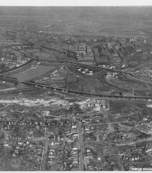
Circa 1930 photograph with an aerial view of the Kansas River looking north and showing the neighborhoods Argentine (left), Armourdale (right), Kensington (left background), and Riverview (right background). The Proctor and Gamble plant is also pictured.
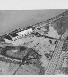
Circa 1930 photograph with an aerial view of the municipal wharf on the east side of state line in Missouri, opposite the airport. This vantage point faces east-northeast with the Missouri River behind the wharf.
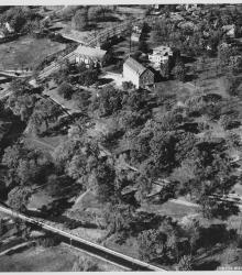
Circa 1930 photograph with an aerial view looking northeast at the intersection of Ward Parkway and State Line Road, showing the campus of Pembroke Country Day School and Brush Creek.