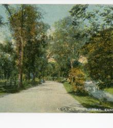
Postcard showing the Al la ma wum ke (Al la ma wun ke) Trail and Indian Lane in the Country Club District in Mission Hills, Kansas. This vantage point faces north-northwest on Indian Lane between Mission Drive and 63rd Street. Brush Creek is shown to the right.
Indian Lane
Displaying 1 - 12 of 31
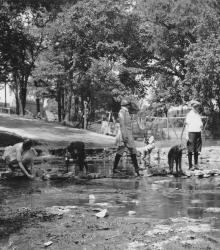
The Indian Lane ford over Brush Creek in Mission Hills, Nichols children in the center, Harriet Smith on the left. This vantage point faces southwest towards the intersection of Indian Lane and 63rd Street, pictured left.
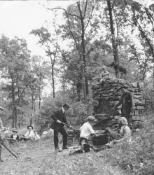
This picnic oven in Indian Hills was a favorite spot of Mr. Nichols, and the family often spent an evening here. Mr.

A view of four children on bicycles riding across the ford just west of the intersection of Indian Lane and Mission Drive. The rustic bridge (pictured right) leads down to the road from the club house, known then as the "The Lodge" and once located approximately at 5930 Mission Drive.
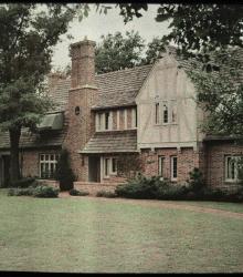
An autochrome photograph of Dr. Thomas G. Orr's residence, taken from the northeast.
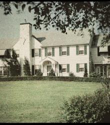
An autochrome photograph of Maurice R. Smith's house, taken from the northeast. Smith was an officer of the Kansas City Life Insurance Company.
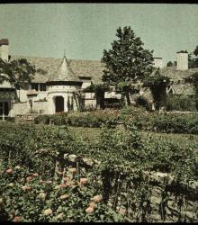
An autochrome photograph of the southeast corner of John E. Horn's estate. The vantage point faces north-northwest towards the Horn residence. Horn was secretary-treasurer of the Paragon Royalty Corporation.
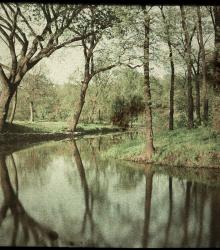
An autochrome photograph of Brush Creek, taken looking east near the Kansas City Country Club entrance.
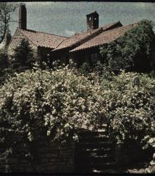
An autochrome photograph of rugosa roses by the house of W. Malcom Lowry, taken from the northeast. Lowry was a Kansas City engineer at Henrici-Lowry Engineering Company.
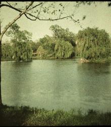
An autochrome photograph looking east over Lake Hiwassee in the Indian Hills subdivision.
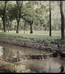
An autochrome photograph of a small waterfall in Brush Creek and a fairway in the Kansas City Country Club.
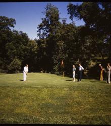
A color glass plate positive photograph of a man putting on the second hole of the Kansas City Country Club Golf Course.