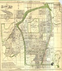
Map of "The Country Club District including Sunset Hill, Mission Hills, Hampstead Gardens, Wornall Manor, Greenway Fields, '1,500 Acres Restricted', Planned, Developed and Offered Exclusively by J. C.
Country Club District
Displaying 1 - 12 of 25
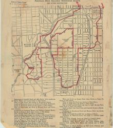
Street map of a "Scenic Route Through the Country Club District: America's Most Beautiful Residential Section, 2000 Acres Restricted." The scenic route is indicated in red; specific directions are at bottom of map. Map shows Kansas City Country Club, Mission Hills Country Club, and names of neighborhoods.
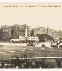
Postcard of the intersection of 47th Street and Mill Creek Parkway (presently JC Nichols Parkway) in the Country Club Plaza. This vantage point faces southwest from near the intersection of Main Street and 46th Street. The Chandler Nursery is pictured in the background as the white building.
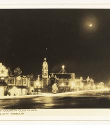
Postcard of the Country Club Plaza lights during Christmas 1937. This vantage point faces south-southwest from the northeast corner of Mill Creek Parkway (presently JC Nichols Parkway) and 47th Street.
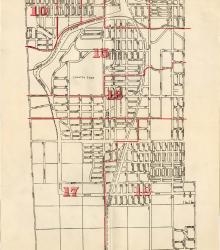
Map showing the boundaries of precincts as defined in 1918 for the fourth ward of Kansas City, Missouri. This ward is bounded by 39th Street to the north, Kansas to the west, south city limits to the south, and Campbell Street and Troost Avenue to the east.
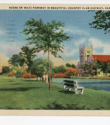
Postcard showing Ward Parkway and a pond between the southbound and northbound lanes of Ward Parkway between 61st Terrace and 62nd Street in Kansas City, Missouri. This vantage point faces north towards the Country Club Christian Church from just west of the southbound lane of Ward Parkway, near 62nd Street.
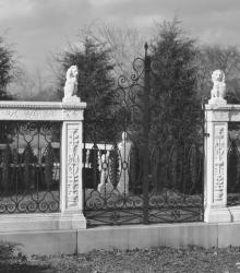
Close exterior shot of the marble balustrade once located at the intersection of Ward Parkway and Meyer Boulevard. This vantage point likely faces north-northeast from the northern curve of Meyer Circle at the intersection of Ward Parkway and Meyer Boulevard
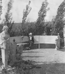
Long stone bench located in The Piazzetta, a woman with a basket of flowers sits in the center of the bench. The Piazzetta (now called Strawn Park after Farrell Clifford Strawn) is located between 63rd Street, Summit Street, and Valley Road in the Greenway Fields subdivision of Kansas City, Missouri.
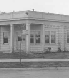
The J. C. Nichols Company sales office at the southeast corner of 59th Street and Ward Parkway in 1919.
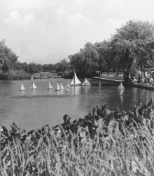
This picture of a lily pond was taken looking north on 62nd Street between the two lanes of Ward Parkway. The Country Club Christian Church can be seen in the background to the right.
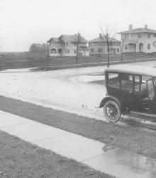
Looking west at 61st Terrace and Summit Street. In the foreground is an automobile, and in the background is a row of houses.
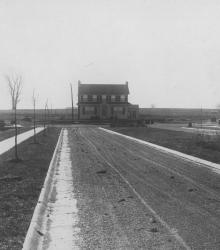
Three homes on 61st street at the end of the completed Belleview Avenue. This vantage point faces south on Belleview Avenue from just south of Huntington Road.