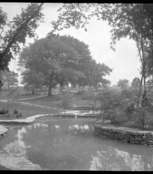
Photograph of a pond in the Quivira Botanical Gardens north of the Lake Quivira Dam in 1931 or 1932. The 10-acre site, included ponds, gardens, springs, and picnic areas.
Parks
Displaying 1 - 12 of 60

Photograph of members of the East Central Garden Club of Kansas visiting Loose Park in Kansas City, Missouri. Nine women are pictured accompanied by five children. Trees, a pond, and pathways are pictured in the background, and a young girl in the front row holds a camera.
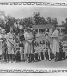
Photograph of members of the East Central Garden Club of Kansas visiting Loose Park in Kansas City, Missouri. Nine women are pictured accompanied by five children. A shelter with attached pergola can be seen in the background of the image.
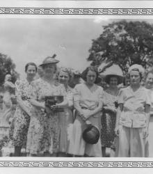
Photograph of members of the East Central Garden Club of Kansas visiting Loose Park in Kansas City, Missouri. The image shows ten women, some largely obscured, with the park's noted rose garden in the background.
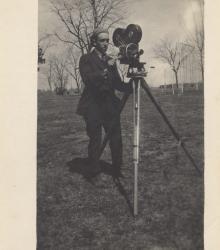
Photograph of an unidentified Overland Park Movie Company cameraman with camera in Aviation Park. The short-lived film company was founded by developer William Strang in 1916.
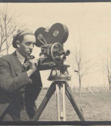
Photograph of an unidentified Overland Park Movie Company cameraman with camera in Aviation Park. The short-lived film company was founded by developer William Strang in 1916.
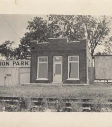
Photograph of a one-story brick building and adjacent wood building in Aviation Park. The wood structure has "AVIATION PARK" painted across its front, and railroad tracks cross the foreground of the image.
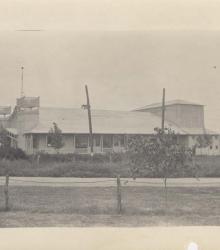
Photograph of a large pavilion building standing in Overland Park, Kansas's Aviation Park.
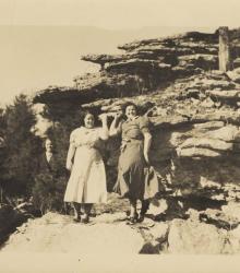
Photograph of three women standing on a stony outcropping in Zimmerman Park circa 1930s. The area, owned by Adolph Zimmerman, was cultivated as a private park and was located northeast of Stilwell, Kansas. The property was purchased by the YMCA and operated as a camp from 1943 to 1998.
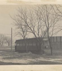
Photograph of a Strang Line trolley car passing in front of tall wooden fence at Aviation Park in the 1910s. The airfield and park was roughly located between 83rd Street on the north and 87th Street on the south, and and Lowell Avenue on the west and Riley Street on the east.
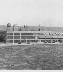
Photograph of the Ford Assembly Plant, located on the east of Winchester Avenue between 10th Street and 12th Street. This vantage point faces east-southeast near the southeast corner of 10th Street and Ewing Avenue.
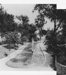
Photograph with slide description: "Wading pool, The Grove, 1914." This vantage point faces east from just north of Benton Plaza between Kansas Avenue and Agnes Avenue.