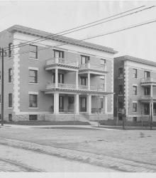
Photograph of the Bentonian Apartments at the southeast corner of 9th Street and Benton Boulevard.
Lykins
Displaying 1 - 12 of 15
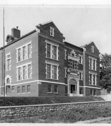
Photograph with an exterior, street view of Lykins School, once located on the north side of 7th Street between Norton Avenue and Jackson Avenue. The school was named after Dr. Johnston Lykins, an early physician and second mayor of Kansas City.
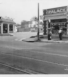
Photograph of H. H. Trenton Tires and Accessories (right) at the southwest corner of Independence Avenue and Monroe Avenue. The Monark Gasoline and Oil Company (left) is also pictured at the southeast corner of Independence and Monroe. This vantage point faces south-southeast from the northeast corner of Independence and Askew Avenue.
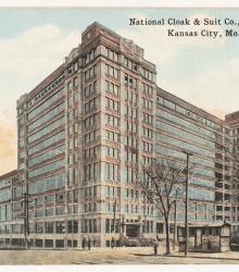
Postcard of the National Cloak & Suit Company, built in 1919 at the southeast corner of Hardesty Avenue and Independence Avenue.
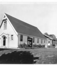
Circa 1925 photograph of the Church of Our Redeemer Lutheran Church located at at the northeast corner of 8th Street and Benton Boulevard. Rev. H. Dierks is listed as the pastor and associated with the Missouri Synod. Addition visible behind the church building.
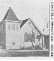
Postcard including an image of the Children's Memorial Lutheran Church at the southeast corner of Independence Avenue and Brighton Avenue. The form correspondence reads, "We missed you Sunday, __. If you are sick kindly let us know. Unless we hear from you we will expect you present next Sunday.

Map showing the boundaries of precincts as defined in 1918 for the seventh ward of Kansas City, Missouri. This ward is bounded by the Missouri River to the north, Lydia Avenue to the west, 9th Street to the south, and Monroe Avenue to the east.
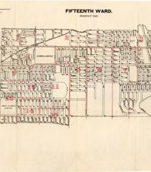
Map showing the boundaries of precincts as defined in 1918 for the fifteenth ward of Kansas City, Missouri. This ward is largely bounded by 9th Street to the north, Cleveland Avenue to the west, 23rd Street to the south, and eastern city limits to the east.
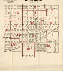
Map showing the boundaries of precincts as defined in 1918 for the ninth ward of Kansas City, Missouri. This ward is bounded by 9th Street to the north, Euclid Avenue to the west, 20th Street to the south, and Cleveland Avenue to the east.
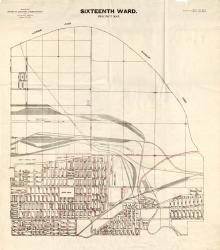
Map showing the boundaries of precincts as defined in 1918 for the sixteenth ward of Kansas City, Missouri. This ward is bounded by the Missouri River to the north, Monroe Avenue to the west, 9th Street to the south, and eastern city limits to the east.
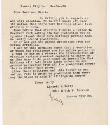
Letter from Lincoln A. Kelly to Governor Lloyd C. Stark, mentioning the election violence of 1934 and the inadequate protection at polling places from the Kansas City Police Department. He writes that "the determination of election workers ... to carry on as they have in the past" makes election violence inevitable.
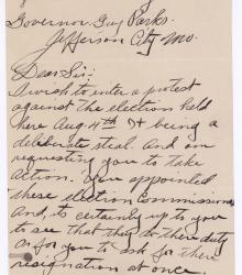
Letter from S. M. Scott to Guy B. Parks reporting his belief that the election of August 4th being "a delibrate [sic] steal."