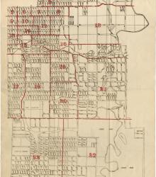
Map showing the boundaries of precincts as defined in 1918 for the thirteenth ward of Kansas City, Missouri. This ward is bounded by 35th Street to the north, Campbell and Troost Avenue to the west, south city limits to the south, and eastern city limits to the east.
Noble and Gregory Ridge
Displaying 1 - 2 of 2
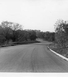
Photograph showing the through paving of Gregory Boulevard near Swope Park, Kansas City, Missouri, ca. 1930s. This vantage point faces west-northwest on Gregory Boulevard from just west of Jackson Avenue.