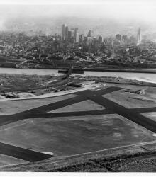
Aerial view of Kansas City's Municipal Airport with the Missouri River and downtown Kansas City, Missouri in the background.
Chamber of Commerce, Kansas City, MO
Displaying 1 - 12 of 23
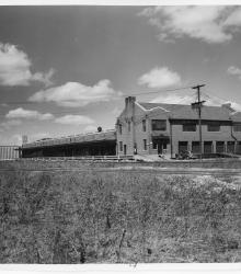
The new municipal wharf on the east side of state line in Missouri, opposite the airport. This vantage point faces northwest with a newly constructed river-rail grain terminal (Kansas City, Kansas) in the far background.
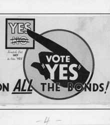
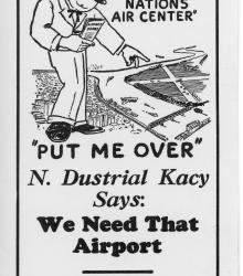
Campaign materials promoting voter approval for civic improvement bonds in Kansas City on May 26, 1931.
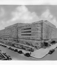
Photograph of the exterior of Kansas City's Municipal Auditorium, ca. 1930s. This vantage point faces southwest from the intersection of 13th Street and Wyandotte Street. The building was constructed at a cost of $6,500,000.
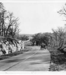
Photograph of Noland Road, south of U.S. Highway 40, looking South. The image is taken in Jackson County, Missouri, and is typical of the county's highways in the 1930s. The entrance to Little Blue Road is pictured in the far background.
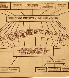
Organizational chart for Kansas City's Ten Year Plan, ca. 1930s, showing how the Civic Improvement Committee, Executive Committee, Finance Committee, Campaign Committee, and various city organizations relate to each other in regards to the sixteen listed Ten Year Plan projects.
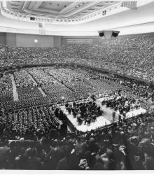
Photograph of the interior of Municipal Auditorium in Kansas City during President Franklin Roosevelt's address, October 13, 1936.
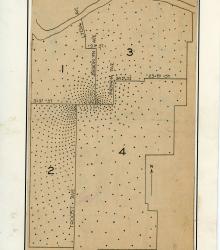
Spot map of Kansas City, Missouri indicating approximate place of residence of the members of the Committee of 1000. This committee was involved in the Ten Year Plan.
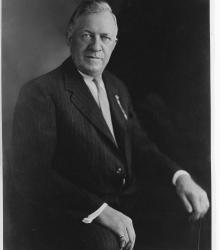
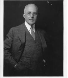
Portrait photograph of Conrad H. Mann, chairman of the Chamber of Commerce and architect of the Ten Year Plan.
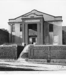
Photograph of the Old Detention Home on Oak Street, south of Fifth Street, ca. 1930s. This vantage point faces west-southwest on Oak Street.