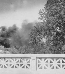
Smoke clouds arising from Lyle Rock Company quarry, located at 48th Street and Baltimore Avenue.
Westport
Displaying 361 - 372 of 515
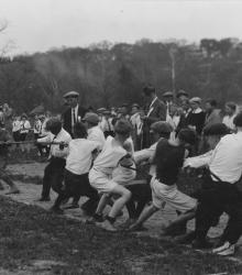
A dozen boys playing tug-of-war while a Community Field Day crowd watches on the grounds of the Pembroke-Country Day School. This vantage point faces east towards Brush Creek and Ward Parkway.
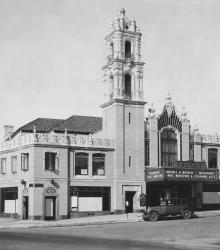
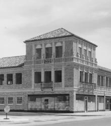
This picture of the Country Club Plaza Theater was taken looking west-northwest at the intersection of Alameda Road (now Nichols Road) and Wyandotte Street.
This picture was taken looking northeast on the Ward Parkway just east of Pennsylvania Avenue.
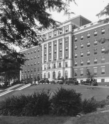
View shows the south wing of St. Luke's Hospital under construction. This was the first addition to the original building. This picture was taken looking southwest just south of the 4300 block of Mill Creek Parkway (now J C Nichols Parkway).
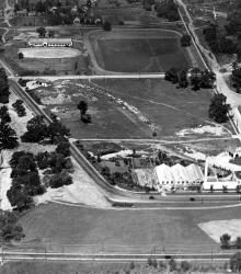
This aerial photograph of the Country Club Plaza was taken near Oak Street just south of 47th Street (now Emanuel Cleaver II Boulevard).
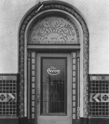
The Avon Shop opened October 1, 1924 at 108 W. 47th Street on the first floor of the Tower Building. This vantage point faces north on 47th Street just west of Mill Creek Parkway (now J C Nichols Parkway).
This picture of the J. C. Nichols Companies Building was taken looking northeast on Ward Parkway just east of Broadway Boulevard.
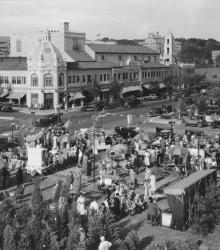
Exterior view of the many people attending the 4th Annual Country Club Plaza Artists' Fair at the southwest corner of Central Street and Alameda Road (now Nichols Road), held from September 7-12, 1935. This vantage point faces northeast towards this intersection from atop the J. C. Nichols Company Building.
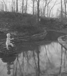
The statue of a small boy and a pool were features of the Crestwood interior park named Happy Woods Park, once located between 54th Street, 55th Street, Locust Street, and Cherry Street. This vantage point faces southeast towards the intersection of Locust Street, 55th Street, and Oak Street in the far right background.
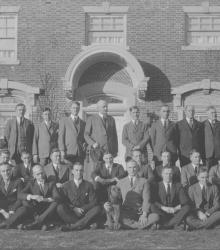
J. C. Nichols Company salesmen organization, taken on the terrace of the J. C. Nichols home at 1214 W. 55th Street. This vantage point faces north towards the residence from just north of Santa Fe Road (now 55th Street) between State Line Road and Ward Parkway.
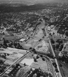
An aerial view of the Country Club Plaza in 1925, looking north-northwest near Brookside Boulevard and 51st Street.