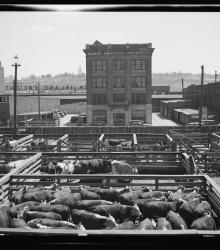
Photograph of the Daily Drovers Telegram and the stockyards in the West Bottoms of Kansas City, Missouri.
This vantage point faces east towards the telegram from just east of the Missouri-Kansas border.
West Bottoms
Displaying 37 - 48 of 75
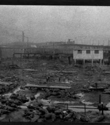
A panoramic photograph showing a fire at the stockyards in Kansas City, Missouri. Many cattle were killed.
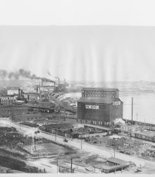
Photograph of "Hell’s Half Acre", an area in the late 1800's and early 1900's consisting of the north side of the West Bottoms between the bluffs and the state line. This vantage point faces northwest from the bluffs near 7th Street and shows 8th Street between Mill Street (now Madison Avenue) and Sante Fe Street.
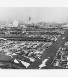
Circa 1930's photograph of the Kansas City stockyards looking northwest from atop the Kansas City Live Stock Exchange Building.
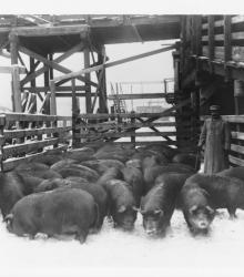
Photograph of a man with pigs in the stockyards. The original slide included the following description: "Moving a pen of Berkshire hogs at the Stock Yards, Kansas City, Missouri."
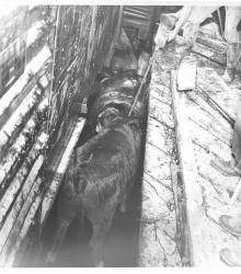
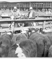
Photograph from the stockyards with partial view of men prodding cattle in a livestock pen with a broomhandle.

Photograph of a man spraying water from a large hose near another man riding a tractor in the Kansas City Stockyards. Handwritten in pencil on the back of photo are the words: "Cleaning pen before another feeding."
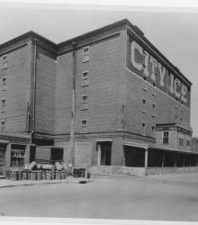
Circa 1930 photograph with frontal and side view of City Ice Company of Kansas City, Plant No. 2; located at southwest corner of 8th Street and Hickory Street and built in 1898. This vantage point faces northwest from the east side of Hickory Street just north of 9th Street.
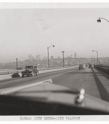
Photograph, which appears to be taken between 1930 and 1940, taken from inside a vehicle driving on the Inter-City Viaduct, looking east with the Kansas City, Missouri skyline in view in the background. The viaduct connects Kansas City, Kansas, and Kansas City, Missouri.
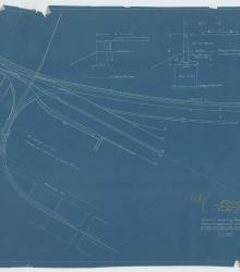
Map depicting locations of railroad lines in the West Bottoms area of Kansas City adjacent to the Stockyards.
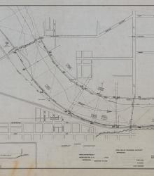
Set of 3 hand-drawn ink-on-linen maps showing the harbor lines for the Kansas River at Kansas City, Kansas, from Turkey Creek to the Argentine Wagon Bridge, showing U. S. Harbor lines, and Kaw Valley Drainage Districts modified lines. Prepared by the Chief Engineer, Drainage Board, for the Kaw Valley Drainage District.