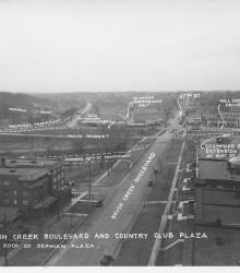
Photograph with caption, "Brush Creek Boulevard and Country Club Plaza [looking west] from roof of Sophian Plaza." The annotations on the photogaph label streets and show proposed road improvements.
South Plaza
Displaying 13 - 24 of 45
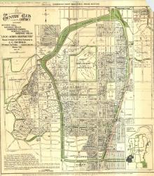
Map of "The Country Club District including Sunset Hill, Mission Hills, Hampstead Gardens, Wornall Manor, Greenway Fields, '1,500 Acres Restricted', Planned, Developed and Offered Exclusively by J. C.
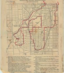
Street map of a "Scenic Route Through the Country Club District: America's Most Beautiful Residential Section, 2000 Acres Restricted." The scenic route is indicated in red; specific directions are at bottom of map. Map shows Kansas City Country Club, Mission Hills Country Club, and names of neighborhoods.
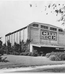
Circa 1930 photograph with full frontal view of City Ice Company of Kansas City, Plant No. 53, built in 1919. It was located on the west side of Oak Street between 48th Street and 49th Street. This property was situated just north of Brush Creek before the waterway was diverted to its current location.
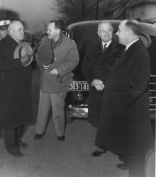
Photograph of Harry S. Truman speaking to James Pendergast following Tom Pendergast's funeral.
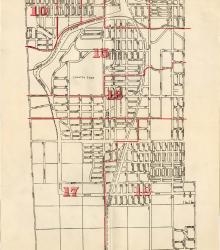
Map showing the boundaries of precincts as defined in 1918 for the fourth ward of Kansas City, Missouri. This ward is bounded by 39th Street to the north, Kansas to the west, south city limits to the south, and Campbell Street and Troost Avenue to the east.
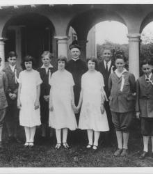
Photograph of the first graduating class of Visitation Church posed with Father Thomas McDonald.
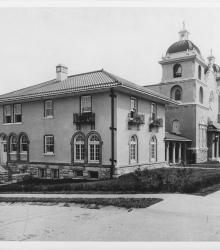
Photograph of Visitation Church (right) and rectory (left) at the southeast corner of Main Street and 51st Terrace.
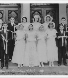
Photograph of Visitation graduating class of 1932 outside of the entrance to Visitation Church. Pictured back row, left to right: John Miller, Dick Livers, Marie Burger, Booty Skinner, Rosemary Lehr, Bob Doyle, Earnie Dunn; front row, left to right: Bill Koehler, Harold St. John, Anna Ruth Crooks, Rita Kelly, Andy Breting, Bill McGonigle.
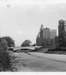
Photograph showing improvements to Brush Creek, Kansas City, Missouri, with the widened Wornall Road Bridge in the background, ca. 1930s. This vantage point faces east from the north side of Brush Creek.
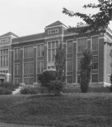
Northern exterior of E. C. White School, first public school in the Country Club District, once located at the northwest corner of 49th and Main Streets. This vantage point faces southeast on a portion of Brookside Boulevard now renamed Ward Parkway, just west of Main Street.
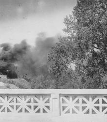
Smoke clouds arising from Lyle Rock Company quarry, located at 48th Street and Baltimore Avenue.