
Photograph of the rear of the Montgomery Ward building at the northeast corner of St John Avenue and Belmont Boulevard. This vantage point faces south towards the complex from Indian Mound Point (Indian Mound Park).
East
Displaying 13 - 24 of 94
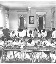
Photograph with slide description, "Campfire Girls working on uniforms at the Whatsoever Community House, K.C., Mo."
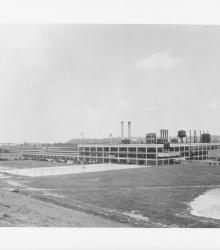
Photograph of the Ford Assembly Plant at the intersection of 10th Street and Winchester Avenue. This vantage point faces northeast on the north side of 12th Street between Ewing Avenue and Winchester Avenue.
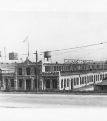
Photograph with slide description: "Weber Gas Engine Plant, Kansas City, Mo. (1926)." This vantage point faces east on the west side of Winchester Avenue between 11th Street and 12th Street.
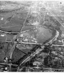
Photograph with an aerial view of the industrial area looking south along the Blue River. Streets shown include Independence Road (presently Wilson Road) (foreground), Independence Avenue (center), and 12th Street (background). Ford Motor Company (right background) and the American Radiator Company (center background) are also pictured.
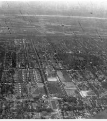
Photograph with an aerial view looking north along Van Brunt Boulevard. Northeast High School and Budd Park is pictured.
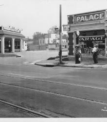
Photograph of H. H. Trenton Tires and Accessories (right) at the southwest corner of Independence Avenue and Monroe Avenue. The Monark Gasoline and Oil Company (left) is also pictured at the southeast corner of Independence and Monroe. This vantage point faces south-southeast from the northeast corner of Independence and Askew Avenue.
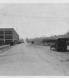
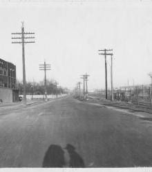
Circa 1925 photograph looking south on Winchester Avenue from just north of the intersection of Winchester and 10th Street.
Circa 1925 photograph looking northeast on Independence Road (presently Wilson Avenue) from just west of its intesection with Wheeling Avenue. Pictured is the Burdett Manufacturing Company (left), the Congregation Tefares Israel Jewish Cemetery (left background), and the Kansas City Terminal Railway (right).
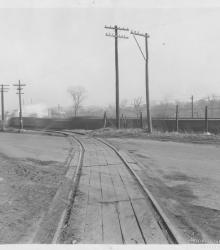
Circa 1925 photograph looking east at the intersection of Independence Road (presently Wilson Avenue) and Wheeling Avenue. Pictured is a train on the Kansas City Terminal Railway.
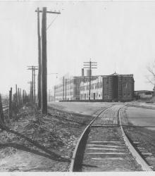
Circa 1925 photograph looking west on Independence Road (presently Wilson Avenue) from just east of its intesection with Wheeling Avenue. Pictured is the Kansas City Terminal Railway (left), and the Huttig Mill Work Company (center).