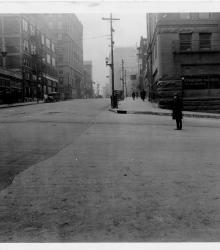
Photograph looking south along the west side of Walnut Street at 6th Street. The Western Union Telegraph building is pictured to the left.
Downtown KCMO
Displaying 121 - 132 of 591
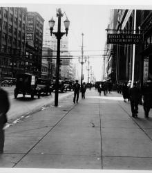
Photograph looking south along the west side of Grand Avenue between 9th and 10th Street. The Lathrop Building (left) and Bryant & Douglas Stationery Co. (right) is pictured.
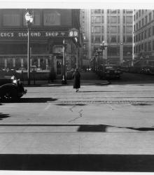
Photograph looking west along the south side of 11th Street from the west side of Walnut Street. Helzberg's Diamond Shop is pictured to the left.
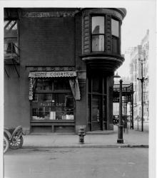
Photograph with full frontal view of the Palace Cafe, located on the southwest corner of 9th and Oak streets. Hotel Gladstone is also pictured in the same building.

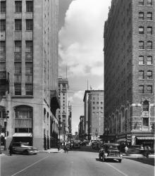
Photograph looking north up Baltimore Avenue from near 16th Street. The Kansas City Power and Light Building is in full view in the center of the photograph. The sign for the President Hotel is also in view on the right.
Photograph of Baltimore Avenue looking north from 14th Street. The description on the back of the photograph reads: "Balt. Ave. looking north from 14th St. Bldg on left [background] is the K.C. Club bldg. and on the right [background] is Kansas City's largest retail furniture store, the Robt.
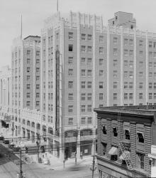
Photograph looking toward the northeast of the Pickwick Hotel located on the east side of McGee Street between 9th and 10th streets in downtown Kansas City, Missouri. The Union Bus Terminal sign is also visible on the building.
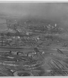
Circa 1930 photograph with an aerial view looking east-northeast across the West Bottoms from Kansas City, Kansas. Includes view of downtown Kansas City, Missouri, as well as the 2nd Hannibal Bridge and the ASB bridge. Both the Kansas and Missouri rivers in view.
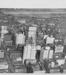
Circa 1930 photograph with an aerial view looking north near 12th Street and Grand Avenue; shows the Bryant Building under construction. Missouri River and riverfront area also in view.
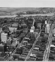
Circa 1930 photograph with an aerial view looking north near 14th and Walnut; shows Kansas City Power and Light and Fidelity National Bank buildings under construction. Both the second Hannibal Bridge and the ASB Bridge are in view as well as the Municipal Airport.
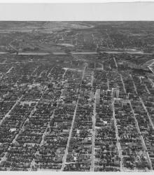
Circa 1930 photograph with an aerial view of the downtown Kansas City area, looking west centered over near 12th and Troost. Includes view of West Bottoms and the Kansas River. Covers around 3rd Street south to near 18th Street.
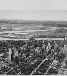
Circa 1930 photograph with an aerial view of downtown Kansas City looking northwest, taken over near 15th Street and Grand Avenue. Shows Missouri River, Municipal Airport, 2nd Hannibal Bridge, and ASB Bridge.