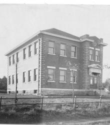
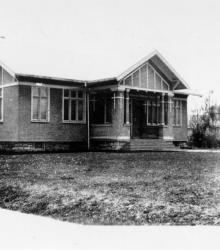
Photograph of the Troost Avenue School, once located at the northwest corner of 60th Street and Troost Avenue. It was named after Dr. Benoist Troost, an early Kansas City physician. This building was no longer used as the Troost School after the 1922-1923 school year.
49-63
Displaying 1 - 12 of 49
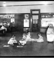
Photograph with an interior view of children in the Troost School kindergarten room.
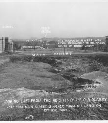
Photograph with caption, "looking east from the heights of the old quarry. Note that Main Street is higher than the land on either side."

Photograph with full frontal and partial side view of Menorah Hospital, located at northeast corner of Rockhill Road and 50th Street.
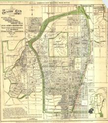
Map of "The Country Club District including Sunset Hill, Mission Hills, Hampstead Gardens, Wornall Manor, Greenway Fields, '1,500 Acres Restricted', Planned, Developed and Offered Exclusively by J. C.
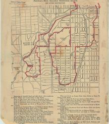
Street map of a "Scenic Route Through the Country Club District: America's Most Beautiful Residential Section, 2000 Acres Restricted." The scenic route is indicated in red; specific directions are at bottom of map. Map shows Kansas City Country Club, Mission Hills Country Club, and names of neighborhoods.
Circa 1925 photograph with exterior, street level view of the front entrance to Kenwood Avenue Methodist Episcopal Church, South, located at the southwest corner of 59th Street and Kenwood Avenue.
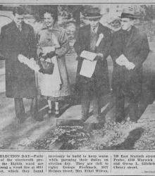
Clipping entitled "Chilly Election Day" from the Kansas City Journal-Post on November 3, 1936 showing Kansas Citians voting at various polling locations on General Election Day.
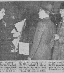
Clipping entitled "Large Ballot Unwieldy" from the Kansas City Journal-Post on November 3, 1936 showing Kansas Citians voting at various polling locations on General Election Day. The caption states, "Mrs.
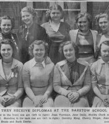
Clipping entitled "They Receive Diplomas at the Barstow School" from May 1937 with caption stating, "Seated in the front row are (left to right) Joan Tureman, Jane Daily, Shirley Clark and Katharine Hall.
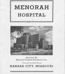
Booklet describing the facilities available at Menorah Hospital, located at 50th Street and Rockhill Road in Kansas City, Missouri. Also included are photographs of the interior and exterior of the hospital as well as a list of the board of directors.
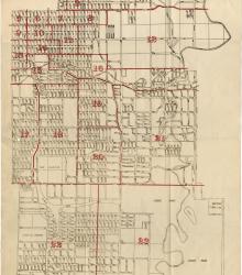
Map showing the boundaries of precincts as defined in 1918 for the thirteenth ward of Kansas City, Missouri. This ward is bounded by 35th Street to the north, Campbell and Troost Avenue to the west, south city limits to the south, and eastern city limits to the east.