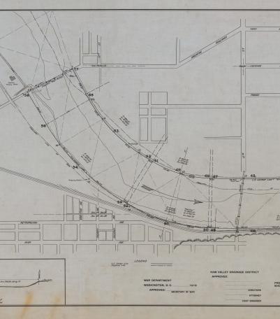
Harbor lines for Kansas River at Kansas City, Kansas
Description:
Set of 3 hand-drawn ink-on-linen maps showing the harbor lines for the Kansas River at Kansas City, Kansas, from Turkey Creek to the Argentine Wagon Bridge, showing U. S. Harbor lines, and Kaw Valley Drainage Districts modified lines. Prepared by the Chief Engineer, Drainage Board, for the Kaw Valley Drainage District. It includes the locations of manufacturers along the river.
Creator:
Genre:
Date:
January 4th 1919
Owning Organization:
Modern Location:
Kansas City, KS
Organization:
Finding Aid URL:
Rights Statement:
Publication, commercial use, or reproduction of this image or the accompanying data requires prior written permission from the Kansas Historical Society. Use of this image also requires that credit be given to the Kansas Historical Society.
Collection Title, Call or Box Number:
north end, ranges 39 & 40
Digital Object Identifier:
KHS-81125-0001


