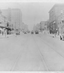
Photograph looking north along Broadway Boulevard from 13th Street. The Hotel Commonwealth is pictured to the left.
Street railroad tracks
Displaying 13 - 24 of 71
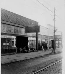
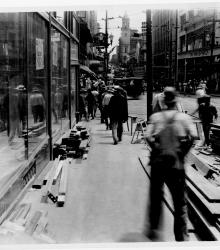
Photograph of storefronts along the south side of 12th Street between Campbell Street and Harrison Street.
Photograph of storefronts along the west side of the 900 block of Grand Avenue. This vantage point faces northwest from the northeast corner of 10th Street and Grand. The R. A. Long Building is pictured to the left.
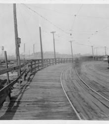
Photograph looking northwest on Brook Street (presently Allen Avenue) between Fairmount Avenue and 23rd Street Trafficway (presently Avenida Cesar E Chavez). The Cudahy Packing Company is pictured in the background.
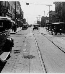
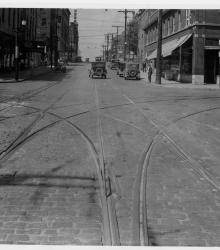
Photograph looking east along 12th Street from just west of Troost Avenue. Aurora Hotel (right) and Eisberg's Drugstore (left) is pictured.
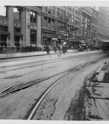
Photograph looking east along the north side of 12th Street from just west of Main Street. The Jones Store is pictured to the right.
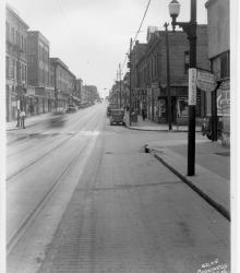
Photograph looking east along 12th Street from just west of Charlotte Street. Troy Hotel, Jake's Bargain Shoe Store, Monarch Hotel, and other establishments are pictured.
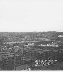
Photograph with caption, "looking southwest from the roof of Sophian Plaza" at the northwest corner of Warwick Boulevard and Brush Creek Boulevard (presently Emanuel Cleaver II Boulevard). The Country Club Car Line and E.C. White School (center background) are pictured.
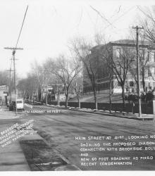
Photograph with caption, "Main Street at 41st, looking north showing the proposed diagonal connection with Brookside Boulevard and new 60 foot roadway as fixed by recent condemnation." The photograph's annotations label streets and show proposed road improvements.
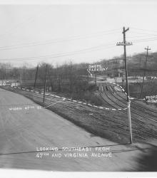
Photograph with caption, "looking southeast from 47th and Virginia Avenue." The photograph's annotations label streets and show proposed road improvements, including plans to widen 47th Street. Paseo High School is pictured.
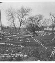
Photograph with caption, "Proposed roadway connections, in Park Land, north of 43rd Street." This vantage point faces north-northwest from near the intersection of 43rd Street and Baltimore Avenue.