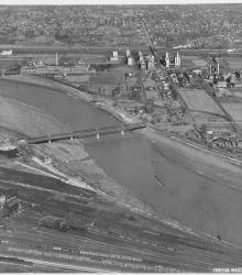
Circa 1930 photograph with an aerial view of the Kansas River looking north and showing the neighborhoods Argentine (left), Armourdale (right), Kensington (left background), and Riverview (right background). The Proctor and Gamble plant is also pictured.
Aerial views
Displaying 13 - 24 of 51
Circa 1930 photograph with an aerial view looking north near 29th Street and Southwest Boulevard. The stockyards, train roundhouse, Kansas River, and Missouri River are pictured.
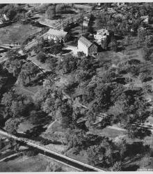
Circa 1930 photograph with an aerial view looking northeast at the intersection of Ward Parkway and State Line Road, showing the campus of Pembroke Country Day School and Brush Creek.
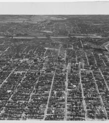
Circa 1930 photograph with an aerial view of the downtown Kansas City area, looking west centered over near 12th and Troost. Includes view of West Bottoms and the Kansas River. Covers around 3rd Street south to near 18th Street.

Circa 1930 photograph with an aerial view looking west near the 3000 block of East 18th Street; shows tip of Ransom Feed Mills, located at 3028 East 18th Street.
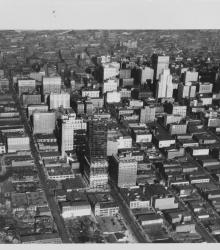
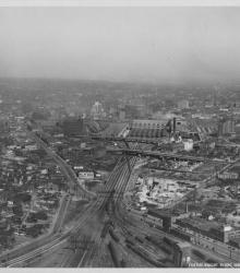
Circa 1930 photograph with an aerial view of downtown Kansas City looking north over near 15th and Wyandotte streets. The Kansas City Power and Light Building under construction, Convention Hall, and Hotel President are pictured.
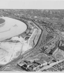
Circa 1930 photograph with an aerial view looking east across the Kansas River near west end of the Kansas Avenue Bridge; shows Cudahy Packing Company, Swift and Company, and the Kansas City Stockyards.
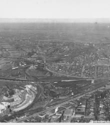
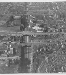
Circa 1930 photograph with an aerial view looking southeast over the Intercity Viaduct and northern part of West Bottoms. Distant view of downtown Kansas City in the top with Quality Hill area and 8th Street Tunnel entrance.
Circa 1930 photograph with an aerial view looking west near 19th and Vine; shows City Workhouse with railroad tracks beside it.
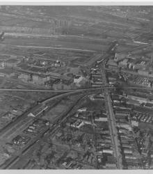
Circa 1930 photograph with an aerial view looking northeast over near 25th Street and Southwest Boulevard; shows the west side of Union Station. Identified on back as "Penn Ave. Viaduct & Union Sta."
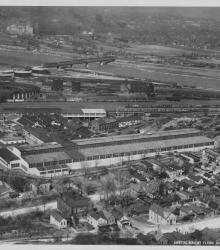
Circa 1930 photograph with an aerial view of Kansas City Structural Steel facility and grounds, once located north of Metropolitan Avenue between South 21st and 24th Street in Kansas City, Kansas.

Circa 1920 photograph with aerial view of New Richards Field which soon became known as Municipal Airport. Hannibal Bridge is pictured in the background.