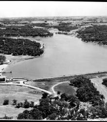
Aerial photograph of Lake Quivira looking south across the dam along the length of the lake in 1931 or 1932. The Lake Quivira Country Club clubhouse and Crescent Beach are visible on the left side of the image.
Curtiss-Wright Flying Service
Displaying 1 - 12 of 33
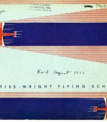
Promotional pamphlet from the Curtiss-Wright Flying school.
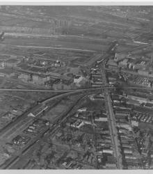
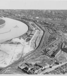
Circa 1930 photograph with an aerial view looking east across the Kansas River near west end of the Kansas Avenue Bridge; shows Cudahy Packing Company, Swift and Company, and the Kansas City Stockyards.
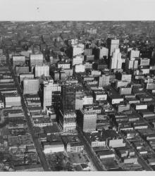
Circa 1930 photograph with an aerial view of downtown Kansas City looking north over near 15th and Wyandotte streets. The Kansas City Power and Light Building under construction, Convention Hall, and Hotel President are pictured.
Circa 1930 photograph with an aerial view looking west near 19th and Vine; shows City Workhouse with railroad tracks beside it.
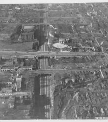
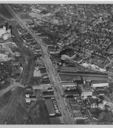
Circa 1930 photograph with an aerial view looking southeast over the Intercity Viaduct and northern part of West Bottoms. Distant view of downtown Kansas City in the top with Quality Hill area and 8th Street Tunnel entrance.
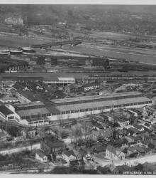
Circa 1930 photograph with an aerial view of Kansas City Structural Steel facility and grounds, once located north of Metropolitan Avenue between South 21st and 24th Street in Kansas City, Kansas.
Circa 1930 photograph with an aerial view looking northeast over near 25th Street and Southwest Boulevard; shows the west side of Union Station. Identified on back as "Penn Ave. Viaduct & Union Sta."
Circa 1930 photograph with an aerial view of Southwest Boulevard looking northeast just east of the state line. Schutte Lumber Company, located at 2931 Southwest Boulevard, is pictured.
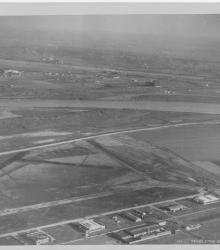
Circa 1930 photograph with an aerial view, looking east, of Fairfax Industrial and Municipal airports.
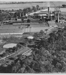
Circa 1930 photograph with an aerial view looking east towards the the Kansas City, Kansas Municipal Plant.
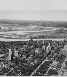
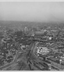
Circa 1930 photograph with an aerial view of downtown Kansas City looking northwest, taken over near 15th Street and Grand Avenue. Shows Missouri River, Municipal Airport, 2nd Hannibal Bridge, and ASB Bridge.