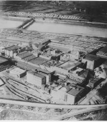
Photograph with slide description, "Air view over Swift's plant to Stock Exchange; Kansas City, Mo. (1927)."
Central Industrial District
Displaying 1 - 12 of 14
Circa 1930 photograph with an aerial view looking north showing West Bottoms and stockyard area. Kansas River and bridges in view. Missouri River in distance on top and 12th Street Viaduct is visible.
Circa 1930 photograph with an aerial view looking east across the Kansas River near west end of the Kansas Avenue Bridge; shows Cudahy Packing Company, Swift and Company, and the Kansas City Stockyards.
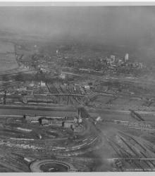
Circa 1930 photograph with an aerial view looking east-northeast across the West Bottoms from Kansas City, Kansas. Includes view of downtown Kansas City, Missouri, as well as the 2nd Hannibal Bridge and the ASB bridge. Both the Kansas and Missouri rivers in view.
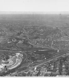
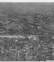
Circa 1930 photograph with an aerial view looking north near 29th Street and Southwest Boulevard. The stockyards, train roundhouse, Kansas River, and Missouri River are pictured.
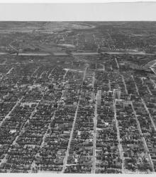
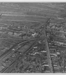
Circa 1930 photograph with an aerial view of the downtown Kansas City area, looking west centered over near 12th and Troost. Includes view of West Bottoms and the Kansas River. Covers around 3rd Street south to near 18th Street.

Map of a stretch of the Missouri River from Quindaro Bend and the Fairfax Drainage District to the East Bottoms Bend. Shows all principal topographic features for a minimum distance of 2000 feet inland, indicating levees, jetties, creeks, and railroad lines.
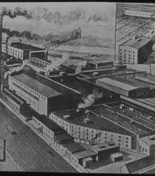
Undated illustration of the Fowler Packing Company meatpacking plant in the Central Industrial District, adjacent to the Kansas City Stockyards.
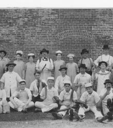
Photograph of unidentified men and women with sausages and other meats; meat stamped with "Fowler's" stamp of The Fowler Packing Company.
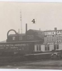
Photograph of an exterior view, including pipe, casing, valves and fittings, of the Sonken-Galamba Corporation at the southeast corner of N. 2nd St. and Lyon Avenue in Kansas City, Kansas in the late 1930s. Sonken-Galamba dealt primarily in metal salvage and smelting.
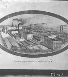
Photographic print of a drawing of the Armour Packing Company, once located at the northeast corner of the intersection of Central Avenue and James Street in Kansas City, Kansas. This vantage point faces north and shows James Street (left) and Central Avenue (foreground).
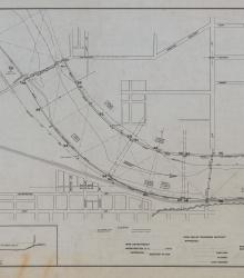
Set of 3 hand-drawn ink-on-linen maps showing the harbor lines for the Kansas River at Kansas City, Kansas, from Turkey Creek to the Argentine Wagon Bridge, showing U. S. Harbor lines, and Kaw Valley Drainage Districts modified lines. Prepared by the Chief Engineer, Drainage Board, for the Kaw Valley Drainage District.