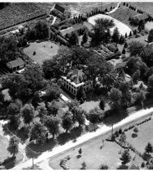
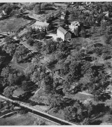
Aerial view of the home of Mr. and Mrs. Lewis G. Wilson at 67th and Glenwood Streets in Overland Park, Kansas, circa 1935. The Wilson residence, at the center of the image, and a neighboring Tudor-style house to the west face 67th Street, which runs across the lower right of the image.
Aerial views
Displaying 1 - 12 of 51
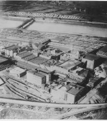
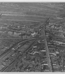
Photograph with slide description, "Air view over Swift's plant to Stock Exchange; Kansas City, Mo. (1927)."
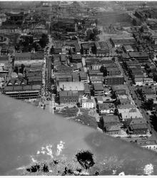
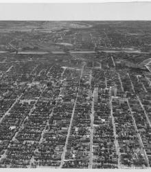
Photograph with an aerial view of the Columbus Park neighborhood of Kansas City, Missouri. The area in view ranges from Charlotte Street on the left hand side of the image to Gillis Street on the right, and from 4th Street at the top of the image to Pacific Street at the bottom.
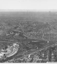
Photograph with an aerial view of the industrial area looking south along the Blue River. Streets shown include Independence Road (presently Wilson Road) (foreground), Independence Avenue (center), and 12th Street (background). Ford Motor Company (right background) and the American Radiator Company (center background) are also pictured.
Photograph with an aerial view looking north along Van Brunt Boulevard. Northeast High School and Budd Park is pictured.
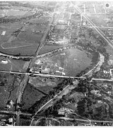
Circa 1930 photograph with an aerial view looking northeast at the intersection of Ward Parkway and State Line Road, showing the campus of Pembroke Country Day School and Brush Creek.
Circa 1930 photograph with an aerial view looking north near 29th Street and Southwest Boulevard. The stockyards, train roundhouse, Kansas River, and Missouri River are pictured.

Circa 1930 photograph with an aerial view looking west near the 3000 block of East 18th Street; shows tip of Ransom Feed Mills, located at 3028 East 18th Street.
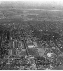
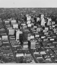
Circa 1930 photograph with an aerial view of the downtown Kansas City area, looking west centered over near 12th and Troost. Includes view of West Bottoms and the Kansas River. Covers around 3rd Street south to near 18th Street.
Circa 1930 photograph with an aerial view looking east across the Kansas River near west end of the Kansas Avenue Bridge; shows Cudahy Packing Company, Swift and Company, and the Kansas City Stockyards.
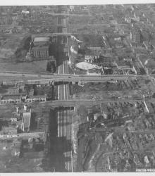
Circa 1930 photograph with an aerial view of downtown Kansas City looking north over near 15th and Wyandotte streets. The Kansas City Power and Light Building under construction, Convention Hall, and Hotel President are pictured.
Circa 1930 photograph with an aerial view looking west near 19th and Vine; shows City Workhouse with railroad tracks beside it.