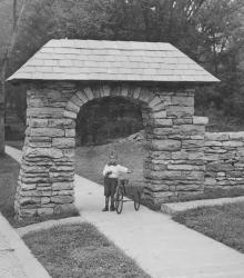
Stone archways were built at each of the entrances into the Crestwood area. This vantage point faces northeast at the intersection of Locust Street, 55th Street, and Oak Street.
The State Historical Society of Missouri-Kansas City
Displaying 121 - 132 of 287
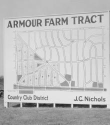
Men and women gaze at a J. C. Nichols Company sign showing available plots for sale in Armour Farm development.
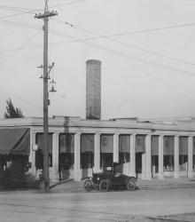
Exterior of Colonial Shops at 51st Street between Brookside Boulevard and Oak Street, showing one automobile parked out front. This vantage point faces northeast at the intersection of Brookside Boulevard and 51st Street.
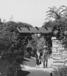
Two residents, a man and a woman, of Greenway Fields walk near the Rams' Heads, a decorative motif for a trellis over the sidewalk on Valley Road near 62nd Street. This vantage point faces north-northeast on Valley Road south of 62nd Street.
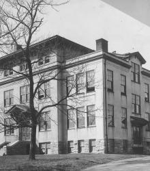
Exterior of the Administration Building of the Country Day School, later called Pembroke Country Day School. It was once located near the southeastern corner of 51st Street and State Line Road. The ground on which this building stood is now the quadrangle of the Pembroke Hill School - Ward Parkway Campus.
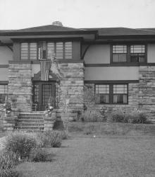
Exterior view of the Clarence E. Shepard home at 1426 Stratford Road (now reclassified as 2012 Stratford Road, Mission Hills, Kansas). This vantage point faces north on Stratford Road between State Line Road and High Drive.

View of Arbor Villa Park. Homes, cherubs, trees, a tennis court, and playground equipment all visible in background. This vantage point faces south towards the intersection of Edgevale Road and Main Street in the right background.
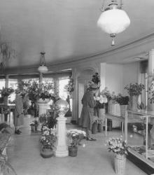
Interior of Chandler's Flower Shop facing north, a man and woman are browsing the store's floral arrangements. The building pictured was once located at the southwestern corner of 47th Street and Mill Creek Parkway (now Baltimore Avenue).
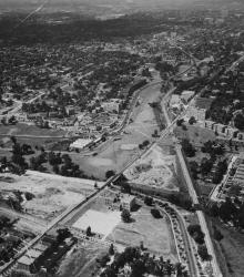
An aerial view of the Country Club Plaza in 1925, looking north-northwest near Brookside Boulevard and 51st Street.
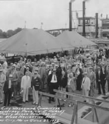
The Kansas City Welcoming Committee to Secretary Patrick J. Hurley and party under the auspices of Missouri River Navigation Association. Mr. Nichols can be seen in the back row, fourth from the left.
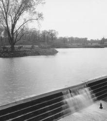
The defunct Lake Hiwassee in Mission Hills, Kansas was bordered by Indian Lane to the west, Wenonga Road to the east, and 63rd Street to the north. The large concrete dam pictured was been built across Brush Creek at this point. This vantage point faces southwest on 63rd Street, just west of Wenonga Road.
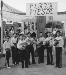
Male mariachi band members with assorted female guests at the 1938 Country Club Plaza Fiesta.