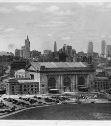
Union Station in Kansas City, Missouri, dedicated in 1914. This vantage point faces north-northeast from Liberty Memorial and shows downtown Kansas City, Missouri in the background.
Anderson Photo Company
Displaying 181 - 192 of 206
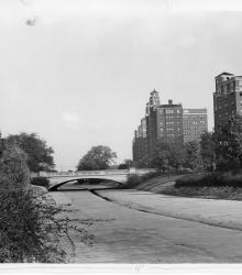
Photograph showing improvements to Brush Creek, Kansas City, Missouri, with the widened Wornall Road Bridge in the background, ca. 1930s. This vantage point faces east from the north side of Brush Creek.
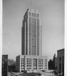
Photograph of City Hall, Kansas City, Missouri, which opened on October 25, 1937. This vantage point faces north-north-east on Oak Street between 12th and 13th Streets.
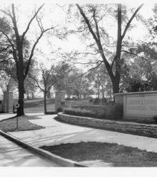
Photograph of the entrance to Jacob L. Loose Memorial Park, Kansas City, Missouri. This vantage point faces south-southwest from the intersection of 51st Street and Wornall Road.
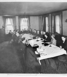
Executive committee at work in preparation of the Ten Year Plan in Kansas City.
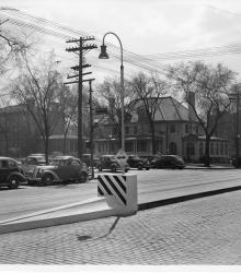
Photograph of "streamlined" Safety Zones intended to protect patrons at streetcar stops, Kansas City, Missouri, ca. 1930s. This vantage point faces south-southeast on Main Street from just north of Armour Boulevard.
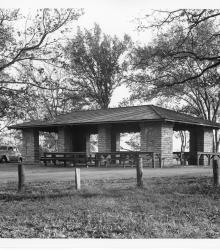
Photograph of a newly constructed shelter house with a picnic oven at Swope Park, Kansas City, Missouri, ca. 1930s. This vantage point faces south-southeast towards Shelter House #4, located just east of present-day Starlight Theatre.
Yates Drive, which provided a new entrance to Swope Park from the north, Kansas City, Missouri, ca. 1930s. This vantage point faces south-southeast from the intersection of 63rd Street, Elmwood Avenue, and Yates Drive (now Starlight Road).
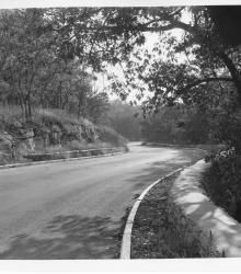
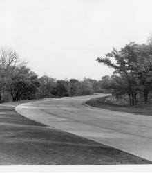
Image of Golf Course Road in Swope Park, Kansas City, Missouri, ca. 1930s. This vantage point faces southwest on Golf Course Road (now Swope Memorial Drive).
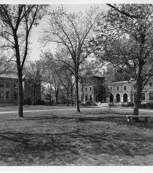
Library and Administration buildings at the University of Kansas City, later University of Missouri-Kansas City. This vantage point faces northwest towards Newcomb Hall (left) and Scofield Hall (right).
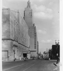
Photograph of the Municipal Auditorium and Power and Light Building in the background, taken along 14th Street, Kansas City, Missouri, ca. 1930s. This vantage point faces east on 14th Street just west of Central Street.
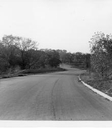
Photograph showing the through paving of Gregory Boulevard near Swope Park, Kansas City, Missouri, ca. 1930s. This vantage point faces west-northwest on Gregory Boulevard from just west of Jackson Avenue.