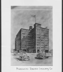
Circa 1928 drawing with frontal and side view of the Ridenour-Baker Grocery Company, located at the southeast corner of St Louis Avenue and Mulberry Street.
West Bottoms
Displaying 13 - 24 of 75
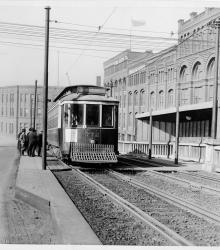
Photograph looking west at a streetcar stopped at the intersection of Hickory Street and the 12th Street Viaduct.
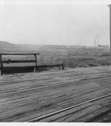
Photograph looking northwest on Brook Street (presently Allen Avenue) between Fairmount Avenue and 23rd Street Trafficway (presently Avenida Cesar E Chavez). The Cudahy Packing Company is pictured in the background.
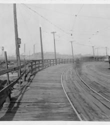
Photograph looking southwest from the 23rd Street Viaduct from the current intersection of Avenida Cesar E Chavez and American Royal Drive. The Kansas City Belt Railroad Bridge is pictured in the background.
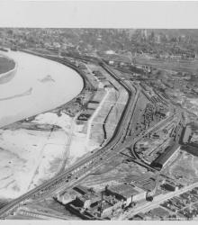
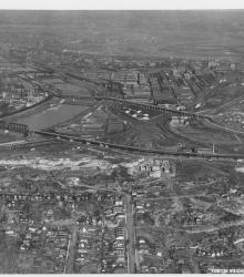
Circa 1930 photograph with an aerial view looking north near 29th Street and Southwest Boulevard. The stockyards, train roundhouse, Kansas River, and Missouri River are pictured.
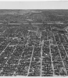
Circa 1930 photograph with an aerial view of the downtown Kansas City area, looking west centered over near 12th and Troost. Includes view of West Bottoms and the Kansas River. Covers around 3rd Street south to near 18th Street.
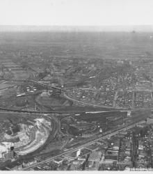
Circa 1930 photograph with an aerial view looking southeast over the Intercity Viaduct and northern part of West Bottoms. Distant view of downtown Kansas City in the top with Quality Hill area and 8th Street Tunnel entrance.
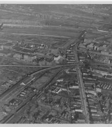
Circa 1930 photograph with an aerial view looking northeast over near 25th Street and Southwest Boulevard; shows the west side of Union Station. Identified on back as "Penn Ave. Viaduct & Union Sta."

Map of a stretch of the Missouri River from Quindaro Bend and the Fairfax Drainage District to the East Bottoms Bend. Shows all principal topographic features for a minimum distance of 2000 feet inland, indicating levees, jetties, creeks, and railroad lines.
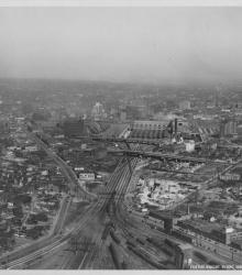
Circa 1930 photograph with an aerial view looking north showing West Bottoms and stockyard area. Kansas River and bridges in view. Missouri River in distance on top and 12th Street Viaduct is visible.
Circa 1930 photograph with an aerial view looking east across the Kansas River near west end of the Kansas Avenue Bridge; shows Cudahy Packing Company, Swift and Company, and the Kansas City Stockyards.
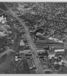
Circa 1930 photograph with an aerial view of Southwest Boulevard looking northeast just east of the state line. Schutte Lumber Company, located at 2931 Southwest Boulevard, is pictured.