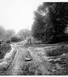
Photograph looking north on Monroe Avenue between 69th Street and 70th Street.
Swope
Displaying 13 - 24 of 86
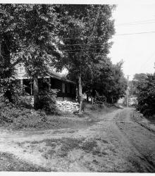
Photograph looking south on Monroe Avenue between 69th Street and 70th Street.
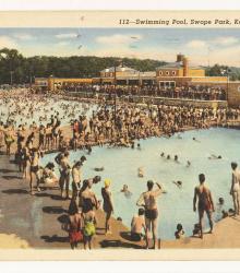
Postcard of the Swope Park Swimming Pool, constructed with WPA funds in 1941 and located north of The Lagoon and west of Blue River in Swope Park. This vantage point faces southeast with the wading pool in the foreground and the larger swimming pool in the background.
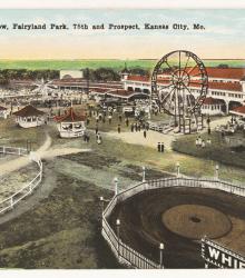
Postcard of Fairyland Park, once located at the southeast corner of 75th Street and Prospect Avenue. This vantage point faces south near the entrance to the park.
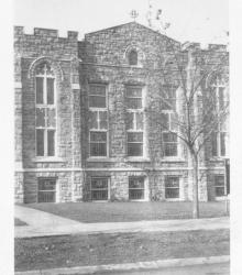
Circa 1925 photograph with partial front view of the Swope Park Christian Church located at the northwest corner of 62nd Street and Swope Parkway.
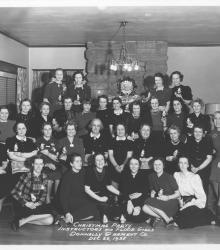
Group portrait of employees identified as instructors and floor girls at a Donnelly Garment Company Christmas party at the Donnelly Clubhouse.
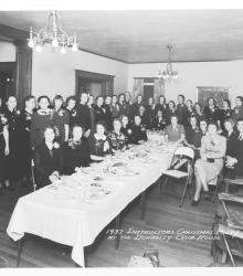
Group portrait of Donnelly Garment Company employees attending the Instructors Christmas Party event at the Donnelly Clubhouse.
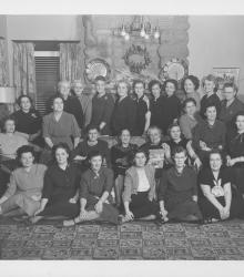
Group portrait of Donnelly Garment Company employees at company Christmas party at the Donnelly Clubhouse.
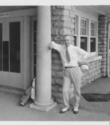
Photograph with full frontal portrait of Frank Cromwell on porch of the Swope Memorial Golf Course clubhouse.
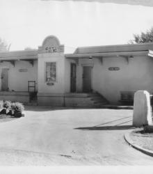
Circa 1932 photograph with frontal and side view of City Ice Company of Kansas City refrigerated route supply station, No. 202, called the Swope Park Station; located at the southwest corner of 67th Street and Myrtle Avenue.
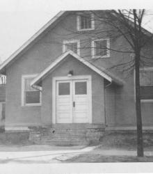
Photograph of South Side Baptist Church, once located at the southwest corner of 54th Street and Montgall Avenue.
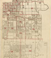
Map showing the boundaries of precincts as defined in 1918 for the thirteenth ward of Kansas City, Missouri. This ward is bounded by 35th Street to the north, Campbell and Troost Avenue to the west, south city limits to the south, and eastern city limits to the east.