
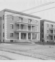
Photograph of the Park Lane Apartments, located on the west side of Mill Creek Parkway (presently J C Nichols Parkway) between just north of 46th Street Terrace.
Kansas City
Displaying 37 - 48 of 1829
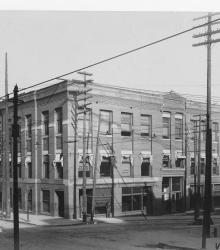
Photograph of the Boston Building, once located at the northeast corner of 8th Street and Wyandotte Street.
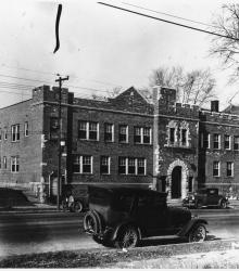
Photograph of the Carmen's Building, located at the southwest corner of Baltimore Avenue and Linwood Boulevard. The building is labeled "Deaner Institute".
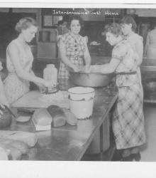
Photograph showing women preparing food in the kitchen of the Interdenominational Home for Girls, located on the west side of Swope Parkway just south of 63rd Street.
Photograph of the Bentonian Apartments at the southeast corner of 9th Street and Benton Boulevard.
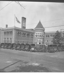
Photograph of bread delivery trucks parked outside of the Campbell Baking Company, located at the northeast corner of 30th Street and Troost Avenue.
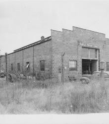
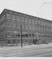
Photograph of the Boyle-Pryor Construction Company Building near the southeastern city limits at that time.
Photograph of the Jefferson Home for Women and Children, once located to the west and north of the intersection of Garfield Avenue and Minnie Street.
Photograph of the Castle Apartments, once located on the west side of Troost Avenue between 26th Street and 27th Street. This vantage point faces northwest near the northeast corner of 27th and Troost.
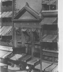
Photograph of the Central Exchange National Bank building, once located on the east side of Grand Avenue (Grand Boulevard) between 10th Street and 11th Street.
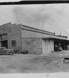
Photograph of the Boyle-Pryor Construction Company Building near the southeastern city limits at that time.
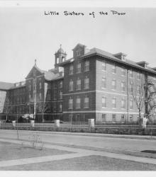
Photograph of the Little Sisters of the Poor building, once located on the west side of Highland Avenue between 53rd Street and 54th Street. This vantage point faces northeast from the northwest corner of Highland and 54th.