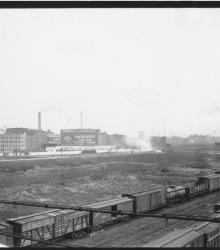
Photograph of the Morris & Company (left) and the Swift & Company (right background) packing plants in Armourdale, Kansas City, Kansas. This vantage point faces south from the Kansas side of the Central Avenue bridge over the Kansas River. Morris & Company was once located where Interstate 670 runs just west of the Kansas River.
Armourdale
Displaying 13 - 17 of 17
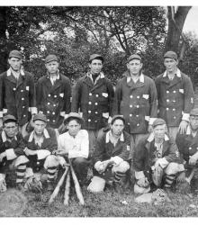
Photograph showing an Armourdale baseball team in Kansas City, Kansas, likely taken in the 1910s. Noted on the back of the image is that the team was managed by Sandy Hanson.
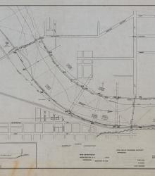
Set of 3 hand-drawn ink-on-linen maps showing the harbor lines for the Kansas River at Kansas City, Kansas, from Turkey Creek to the Argentine Wagon Bridge, showing U. S. Harbor lines, and Kaw Valley Drainage Districts modified lines. Prepared by the Chief Engineer, Drainage Board, for the Kaw Valley Drainage District.
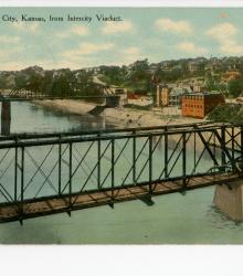
Postcard showing the Intercity Viaduct (foreground), James Street (background), the Kansas River (left), and Kansas City, Kansas (right). This vantage point faces southwest from a railroad bridge northeast of the Intercity Viaduct. The back of the postcard includes a short letter to Mrs. Lee Moore of Lock Springs, Missouri.
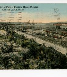
Postcard showing part of the Packing House District in Kansas City, Kansas. This vantage point faces northwest towards 5th Street in foreground (now replaced by Interstate 70), Central Avenue Viaduct to the left, and Morris & Company Packing House to the right.