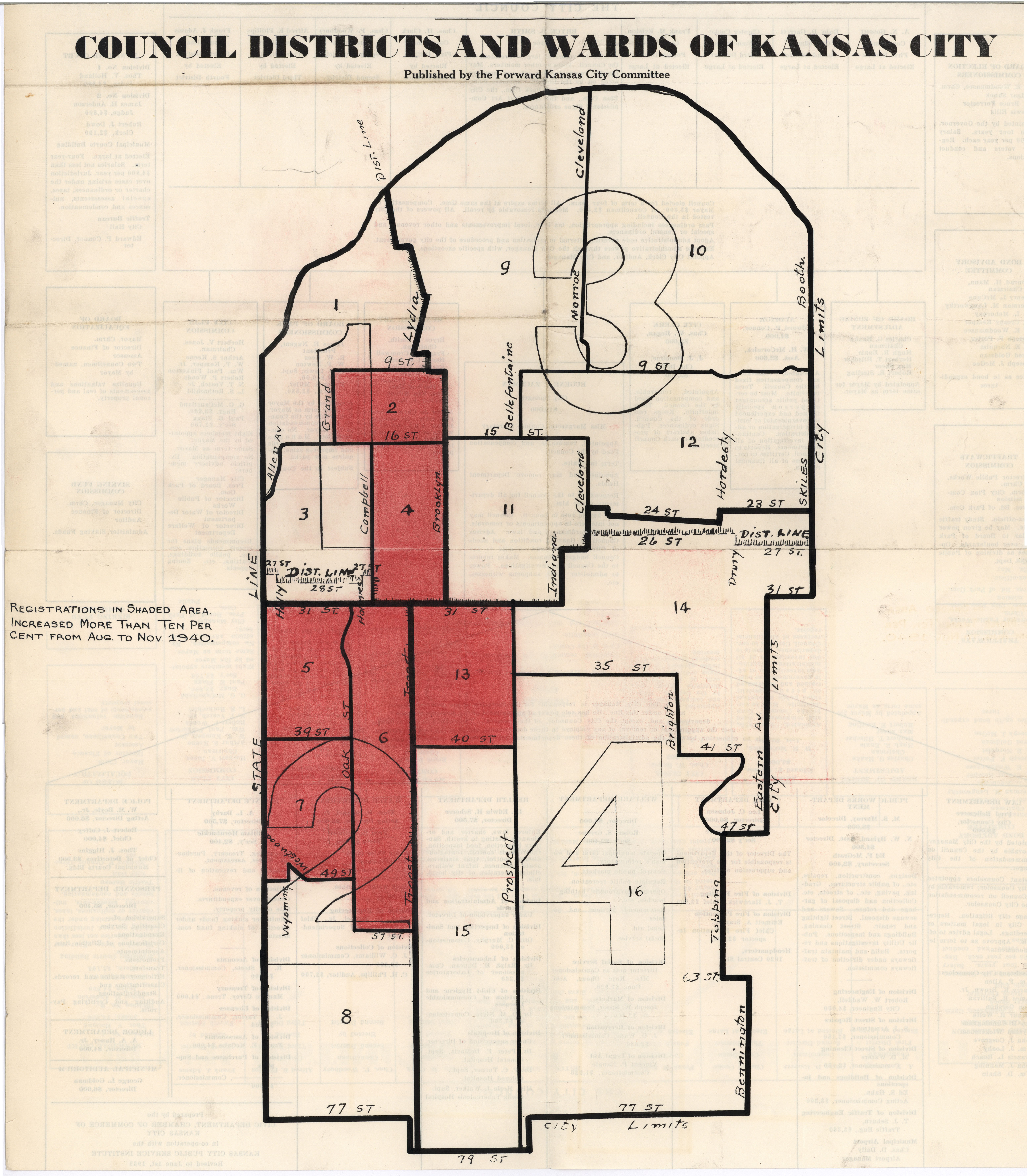
Council Districts and Wards of Kansas City
Description:
Map of Kansas City council districts and wards from the Missouri River south to the then-city limits at 77th and 79th Streets, and from the Kansas state line east to the eastern city limits. Shaded areas show increase in voter registrations of more than 10% between August and November 1940.
Creator:
Genre:
Date:
1940
Owning Organization:
Modern Location:
Kansas City, MO
Organization:
Rights Statement:
Publication, commercial use, or reproduction of this image or the accompanying data requires prior written permission from the State Historical Society of Missouri-Columbia. Use of this image also requires that credit be given to the State Historical Society of Missouri-Columbia.
Collection Title, Call or Box Number:
Stark, Lloyd Crow (1886-1972), Papers, 1931-1941, C0004
Digital Object Identifier:
SHSMO-C0004-F04333-0002
